Easy Hikes and Slow Life in Mount Shasta
With my Cotopaxi backpack strapped tight to my back and my hiking boots on my feet, I made my way to the Zipcar I’d booked for the weekend to embark on a family trip to Mount Shasta.
Travel Tip: When planning a trip to Mount Shasta (or Tahoe or anywhere) from San Francisco, avoid Friday afternoons. Opt for sunrise on Saturday morning (this worked great for the wakeboarding trip on Lake Shasta I did last year) or mid-afternoon on a weekday.
Despite the solid red line of traffic from the East Bay to Sacramento (occasionally turning orange with brief stints of blue), the drive wasn’t too bad. Thanks to a recommendation from a coworker, we stopped at the Olive Pit in Corning to grab some road trip sandwiches, olive oil, and stuffed olives.
It was around 7:40pm when we finally arrived in Shasta.
Why Shasta?
We were visiting a family friend who’d grown up in Pacific Beach, San Diego with my mom. He’d been a teenager when she was a pre-teen and had caught the ski bug in his early twenties. This bug, it turned out, bit him harder than the surf bug had (he’d spent his youth as a surfer), and he’d moved up to Shasta to live closer to the snow.
I’d visited once before when I was 10 or 11 years old. Even at that age, I’d known it was someplace special.
He’d built his house himself, carving custom designs into reclaimed wood, assembling it to create the pitched roof with intricate interior architectural details, and creating detailed stone murals throughout.
Doing this type of work for clients (storefronts, residential) along with jobs at ski shops and resorts, had afforded him a life in the mountains with his dogs.


Walks in the Woods: Meandering Outdoors on Mount Shasta
We were only there for the weekend and wanted to spend as much of our Saturday as possible outdoors. My parents also wanted to see what the old ski resort (n longer running) looked like now. So we identified some trails that were described as “easy” and headed up the mountain.
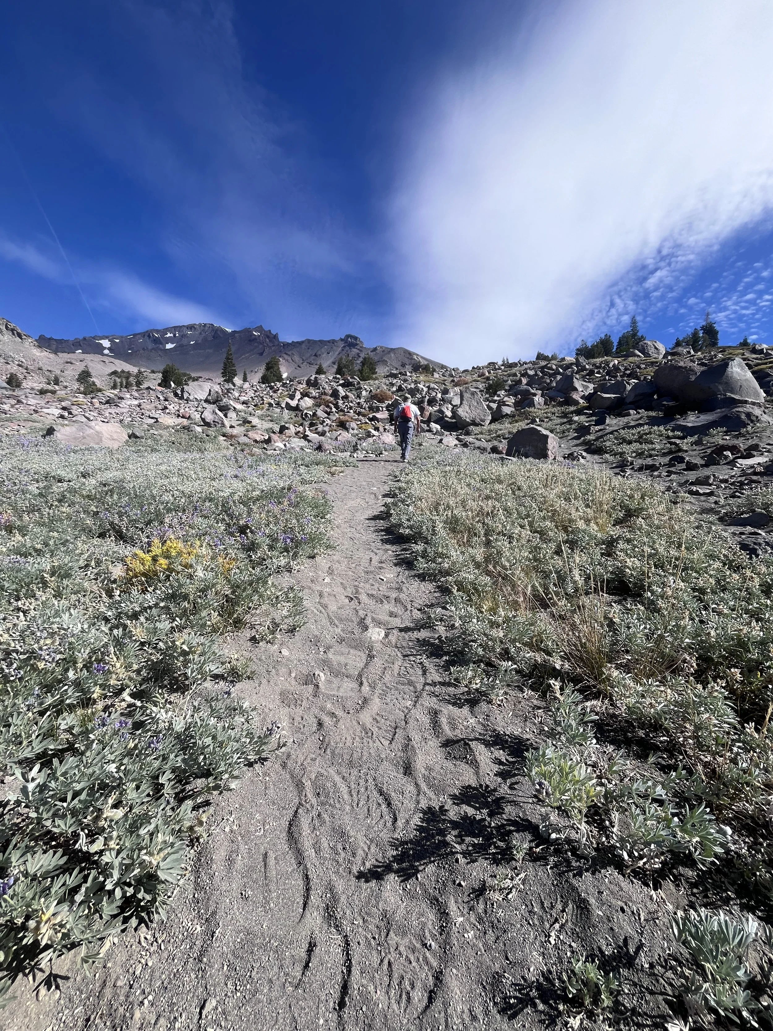
Trail One: Old Ski Bowl Trailhead
We packed ourselves into the Zipcar once more and drove up to the base of the old Ski Bowl. There, we hiked a very short way up, less than a quarter mile, to take in views of the mountain range to the left and Mount Shasta straight ahead.
Swooping lines of snow could still be seen on the brown face of the mountain, though each year, the temperature and weather promised less snow than the year before. Along the path, wildflowers bloomed, and pine trees dotted the hills in the distance.
We didn’t stay long because our plan was to do the full Panther Meadows hike which was located a bit lower down the mountain.


Trail Two: Panther Meadows
It was a short five-minute drive down to the trail for Panther Meadows. The trail was an out-and-back, the first half ending at a campsite further down the mountain.
We ran into another kook at the start of the trail, a woman in a flowy top who had dropped her phone between two rocks. We tried to help her by calling fire services, but they weren’t available on Saturdays. Unfortunately, that was the best that we could do. We wished her luck and hoped she’d be able to catch her flight the next day.
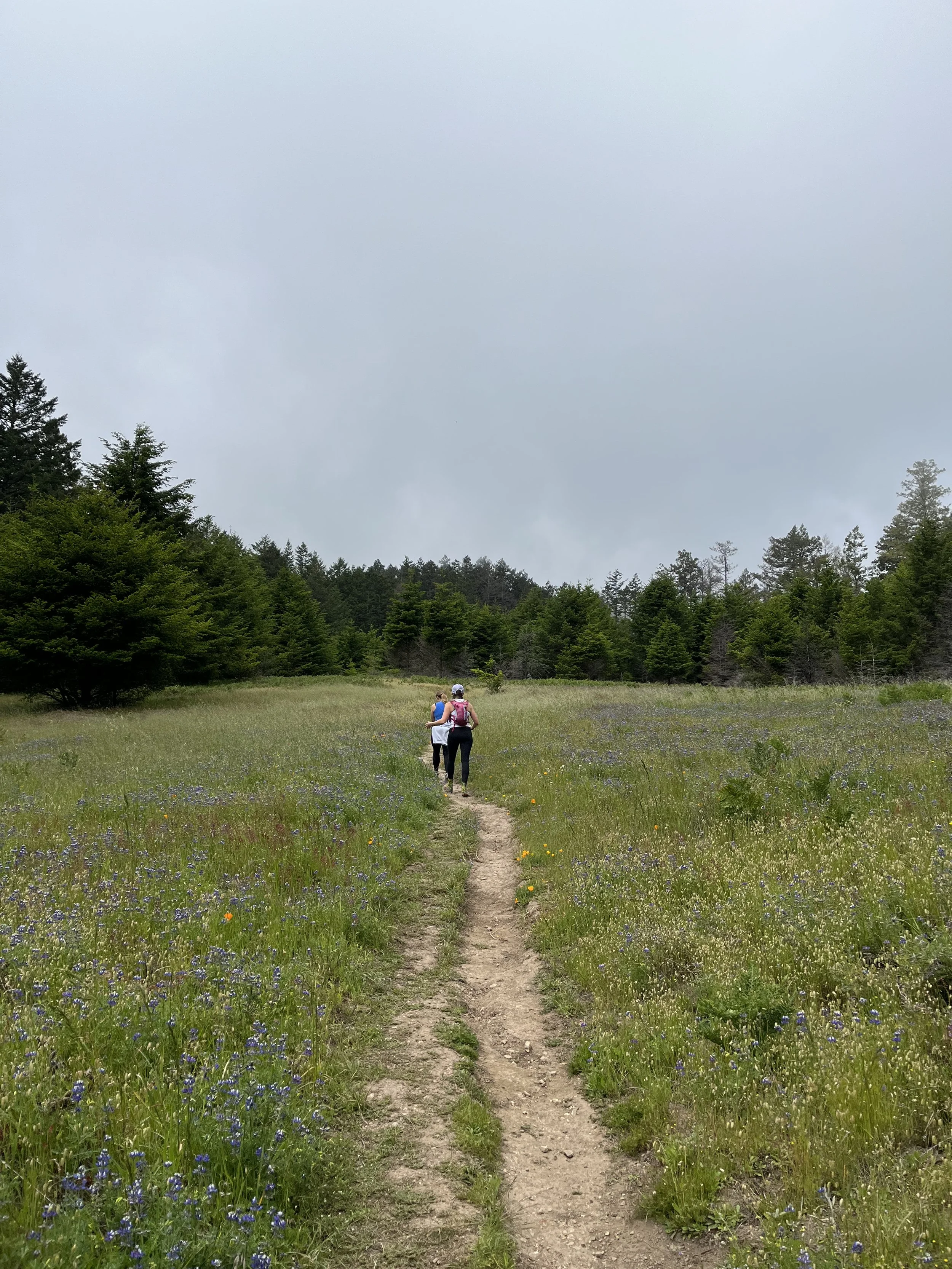
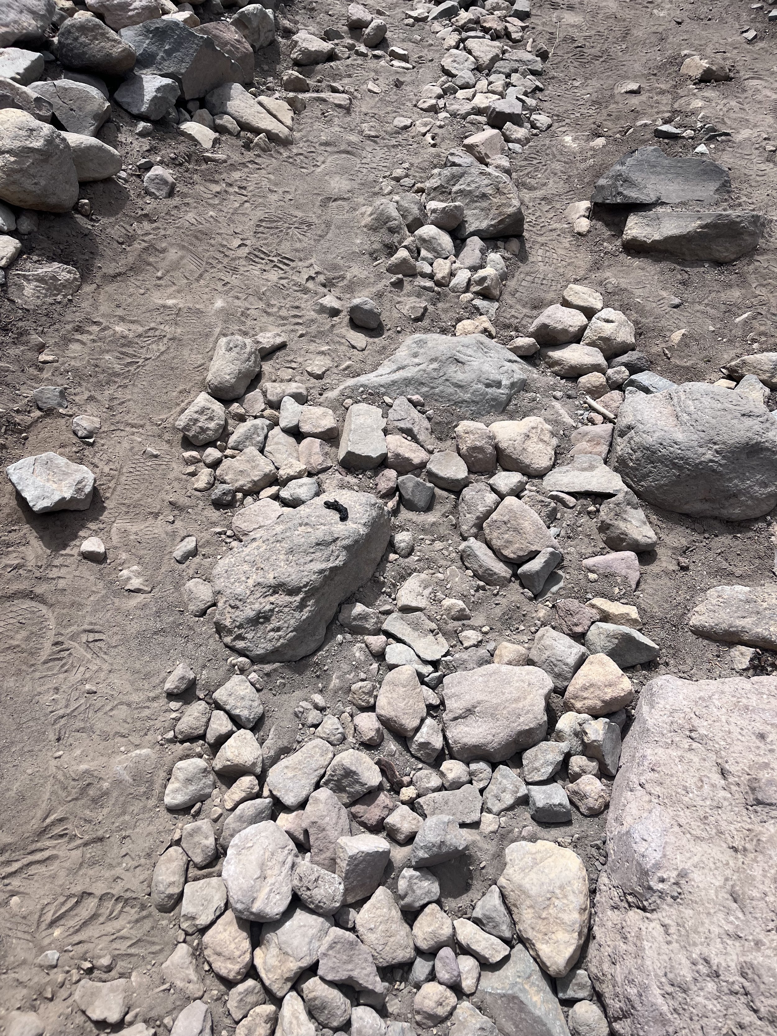
Then we began our walk along the dusty stone-lined paths, glancing up at the mountains that surrounded us with their magnificent peaks. Soon, we came to the first meadow of this hike, a trail of stones functioned as pavers, leading across its grassy terrain.
As we crossed this meadow, we passed hippie campers on a stroll who, rather than offering the usual breathy “hi” that hikers mouth when passing each other, they whispered “blessings”. I wasn’t sure how I felt about someone bestowing a spiritual message onto me..
At the other end of the meadow was a forest. We followed a marked path, lined with smaller rocks. The path was clearer in some places than others. My dad began hypothesizing about the native tribes that must have lived in the area, and as we rounded the corner, a Park Ranger overheard.
She was helping to lead a group of volunteers who were working with her and a few other rangers to fix up the trails (if I lived on Mount Shasta, I’d definitely do this too). She piped in with information about the tribes who actually had lived there—the Wintu and the Pit River Tribe—and explained that this was sacred land and they were working to make sure the trails were well-defined so as to keep feet from wandering into areas that benefited from no human contact.
We passed two other groups of volunteers before exiting from the forest into another meadow. This one was lined with pine trees and had pops of lime green grass amongst the dark mossy greens and gray-brown of the rocky path.
After crossing this meadow, we found ourselves at the Panther Meadows campsite. A brown wooden outhouse (or crazy-box as I call them) with slats of cracking brown wood was available there, so we hopped inside for a quick pee before backtracking for a trail marked “drinking stream.”
There was, indeed, a stream, but it was farther away than we expected it to be. We wandered past a campsite where a shirtless man played guitar (terribly, but happily). After descending a dirt hill, stepping between raised roots, we came to the stream which flowed over rocks and down to an area where the hill grade flattened out.
I assumed that this was the drinking stream, and was named because it was potable, so I knelt to fill my Nalgene water bottle. I haven’t gotten sick yet, so it would seem the water was safe to drink from.
After that, it was a hike back up the hill, through the meadow, into the trees, across the second meadow (taking the time to sit on a couple of rocks to stare up at the mountains surrounding us), then back to the parking lot where we got back into our Honda to drive down to Bunny Meadows.


Trail Three: Bunny Meadows
This was our third walk/hike of the day, and we were pleased that the trail began with an ascent because this meant it would be downhill on the way back. Having crossed so many meadows in one day, I was not surprised when my mom asked, “how do meadows exist?”
It was a question that I would seek the answers to later. In this discovery process, I would uncover the concerning fact that meadows are beginning to disappear at a faster rate than before.
At the top of the hill was a sign that offered two separate paths. One led to the base of the ski bowl while the other would take us to a hut (apparently).
We chose to walk toward the hut, once again moving over rocks and through trees, entering meadows and finding ourselves back in forests.
As we know, I’m a pretty big kook, and along the way, my mom would prove that the apple does not fall far from the tree.
She’d removed her glasses because she didn’t enjoy hiking with them and felt that they sometimes made her feel a bit sick. We were making our way over larger rocks spilled into the hiking path, and I noticed a bit of scat on one of the stones.
A few minutes after I passed it, I heard her stop behind me.
“Oh!” She exclaimed, “a blue caterpillar!”
I turned around and she was staring down at the rock with the scat I’d just passed.
“That’s poop, mom,” I said.
“No,” she argued, staring down and shaking her head, “it just moved!”
I turned around and marched back over to her. It was, indeed the thin excrement that I had seen earlier and I couldn’t help but giggle.
“Nope,” I declared, “that is definitely poop.”
“Yikes. Guess I really do need my glasses!” She said, which was an understatement.
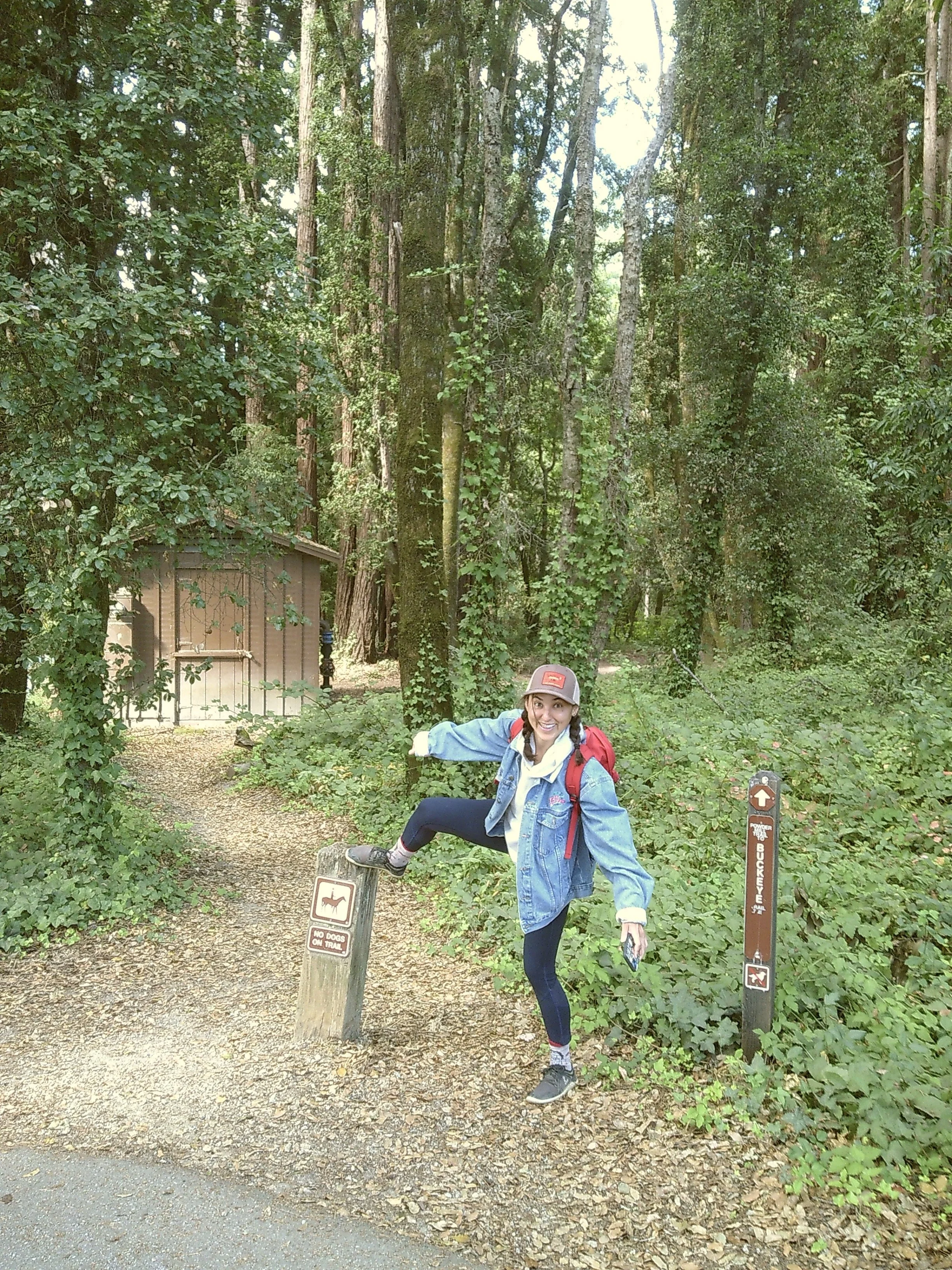
We continued on, and noticed that the trail signs no longer promised a hut, but rather a sandy trail or a horse camp. After ascending another hill, there was a trail sign that stated it was another 0.7 miles to the horse camp.
We decided to turn around instead of finishing the hike. It was already 1pm and we still wanted to hit one more trail which was a 30-minute drive away to see some waterfalls.


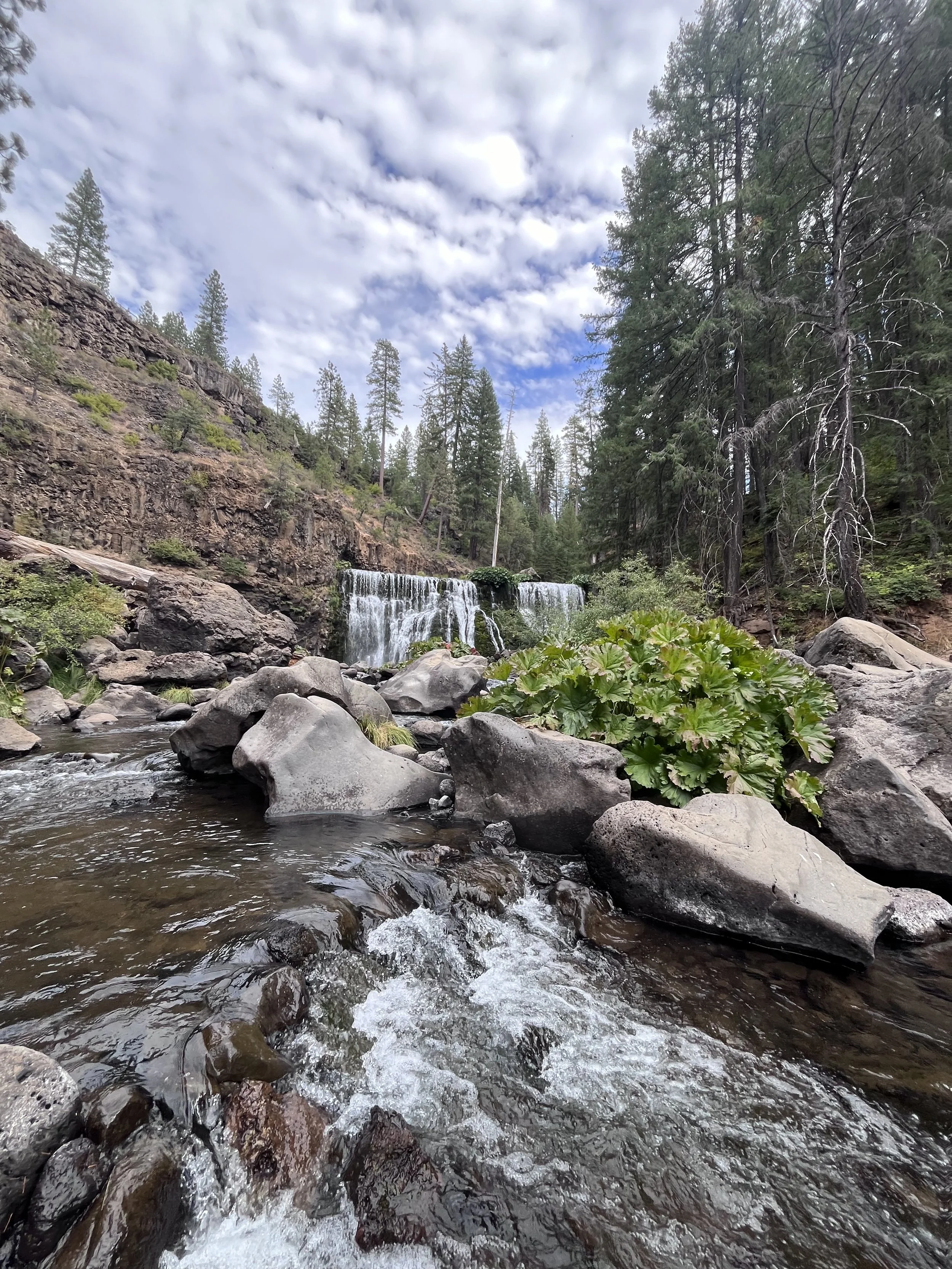
Trail Four: McCloud Middle Falls
There’s a bathroom at the base of Bunny Meadows which I used before we all piled back into the car to drive out of Shasta and into McCloud. We moved along wide roads lined with pine trees until we came to a turn-off which led us directly into the parking lot for the trail.
It was more popular than the others, though not nearly as popular as trails back in California, and it was only five minutes into the walk when we came to a viewpoint.
From the top of the mountain, we could look down at the falls and see the tiny specs of other people who had come for a little adventure. There were a lot of families who had obviously spent the day there, many in bathing suits, enjoying a swim in the cold water.
We walked down to the base of the falls, following the dirt trail with its curving switchbacks until we came to the rocky shoreline. We decided to move past the main area to a portion of boulders a few feet away.
I climbed across a few to get closer to the falls.
It was a bit of a wild scene with kids scampering across rocks, families enjoying drinks, and one kid throwing rocks (and almost hitting me) until his dad caught him and gave him a scolding.
After sitting for a while and admiring the falls, we made our way back up the trail, sticking to the switchback while a family with a wagon tried to ascend directly up… they were out of breath and sweating as we passed them at the top.


Ending the day with pizza and beer
This final trail was the last of our walks that day and we were ready for some grub, so we drove back to the cabin in Mount Shasta. We drank some Pacificos while we waited for our pizza order, then drove into the small town to collect it. Back at the cabin, we enjoyed the delicious slices (piled high with veggies for me) around the antique wooden table our family friend had sourced for his house.
In my opinion, there’s no better way to end a day of hiking than by devouring some pizza and cracking open a beer, so this day was pretty much perfect for this ol’ kook.