Hiking the Dipsea Trail: Muir Woods to Stinson Beach
What to know about hiking the Dipsea Trail from Muir Woods
Trailhead Parking:
If you start at Muir Woods National Monument (like we did), you’ll need to reserve a parking spot.
Make the reservation at least a few days in advance on the Muir Woods website
Parking is $10 per vehicle
The trailhead is located outside of the park, so you don’t need to have a park pass or pay an entrance fee (though I always support money going to our parks).
Level: Intermediate
I’d classify this hike as an Intermediate trail. This is mainly due to the time you spend on your feet, not necessarily strenuous inclines. We were exhausted at the end, but that’s because we don’t often hike further than 6-7 miles, and I hadn’t done an all-day hike in a long time.
The hike is 10 miles if you follow the AllTrails map exactly. We tracked our distance as 13.2 miles. This included the walk to the trailhead from just outside Muir Woods National Monument, a stroll down to the beach, and our decision to take a slightly different trail on the way back to make the hike a loop rather than an out-and-back.
There are some steep uphill sections, but if the distance was cut in half, I’d qualify this hike as easy/intermediate.
What to pack:
Water. It’s a full-day hike, and you’re going to get thirsty. Luckily, there are refill stations at the top of the mountain and down at the beach, but having a full water bottle at the start is a very good idea.
Snacks. I packed trail mix and some peanut butter protein balls to have with us. About halfway through the hike, I was starting to get pekish and was very happy to have these.
Layers. You’ll be shaded by trees (which can make for a chilly section of the trail, especially after you’ve been sweating), and you’ll also be out in the sun (hot, hot, hot as you hike).
Gossip. It’s a long hike. Make sure you have something to talk about with your friends, family, or yourself.
We were late to the hike (Skip this section if you want to go straight to the hike description)
We were late. About thirty minutes late… No surprise, but I’d like to think it wasn’t entirely my fault.
The first fiasco was when I ordered three breakfast sandwiches from the cafe on Pine and Leavenworth, but the barista (seeing only two people) had thought I’d only ordered two. I should have clocked it when she only asked for two cheese preferences, but I figured she thought both vegetarian sammies would have the same type of cheese, and the meat sandwich would have the other.
Besides, I was more focused on getting my cold brew.
It wasn’t until five minutes after the first two sandwiches were handed over, and the coffee was starting to run through me (aka it was time to go to the bathroom), that I realized the third sandwich was not coming.
That third sandwich was for a friend who was joining us on the hike. We’d already confirmed we’d have breakfast for him when we picked him up, and there was no way we could deny him the absolute joy that is one of this cafe’s thick English muffin sandwiches. So, we ordered the third, and waited for it to be made.
That put us about twenty minutes behind schedule. Luckily, I’d banked an extra ten to begin with.
Unfortunately, the sandwiches would not be the only obstacle we faced on the way to Muir Woods.
After we picked up our friend, we drove to the Sunset District (where my boyfriend lives). We had to feed his cats before we left, and before that, we needed to stop to refill his car with gas and add air to his car’s tires. Though necessary, this added an extra five minutes. On top of that, we spent another five trying to get his personal air pump to work, before giving up, and using the gas station’s.
Then it was a very quick drive up the street to feed the cats. A task that usually only takes another five minutes.
Oh, but of course! That was not the case on the one day we had a timeline. When we got into the apartment, we discovered that the cats had knocked over a glass propagation jar. Tiny shards of glass were everywhere, and we spent at least ten minutes cleaning them all up.
When we finally hit the road, we were thirty minutes late.
Here’s something else to be aware of:
You may not have cell service in Muir Woods
This is lovely for unplugging and being one with nature. Not so great when you’re running late, and trying to let your other hiking crew members know.
Starting the Dipsea Trail hike
The path we took started outside of the Muir Woods National Monument. As you have probably guessed, by the time we had finally arrived, I had to pee. Luckily, there’s a bathroom outside the park, which a few of us used before turning around and walking back the way we’d come, toward the parking areas.
At the start of the hike, you walk on a path right next to the road. At a certain point, you either cross to the other side or walk along the road itself. This doesn’t last for long, but it’s something to be aware of, especially if you’re hiking with small children. There aren’t many cars driving on this road, but it is still important to keep your wits about you.
After a short walk on the road, we turned off to the right where the trailhead began.
The trail was wide and clear. Gray gravel stones crunched under our boots as we made our ascent. My personal preference is to begin hikes going uphill because it often means we’ll get to descend on the way back. Although we ended up taking another trail back on the way back from Stinson Beach, this still turned out to be the case.
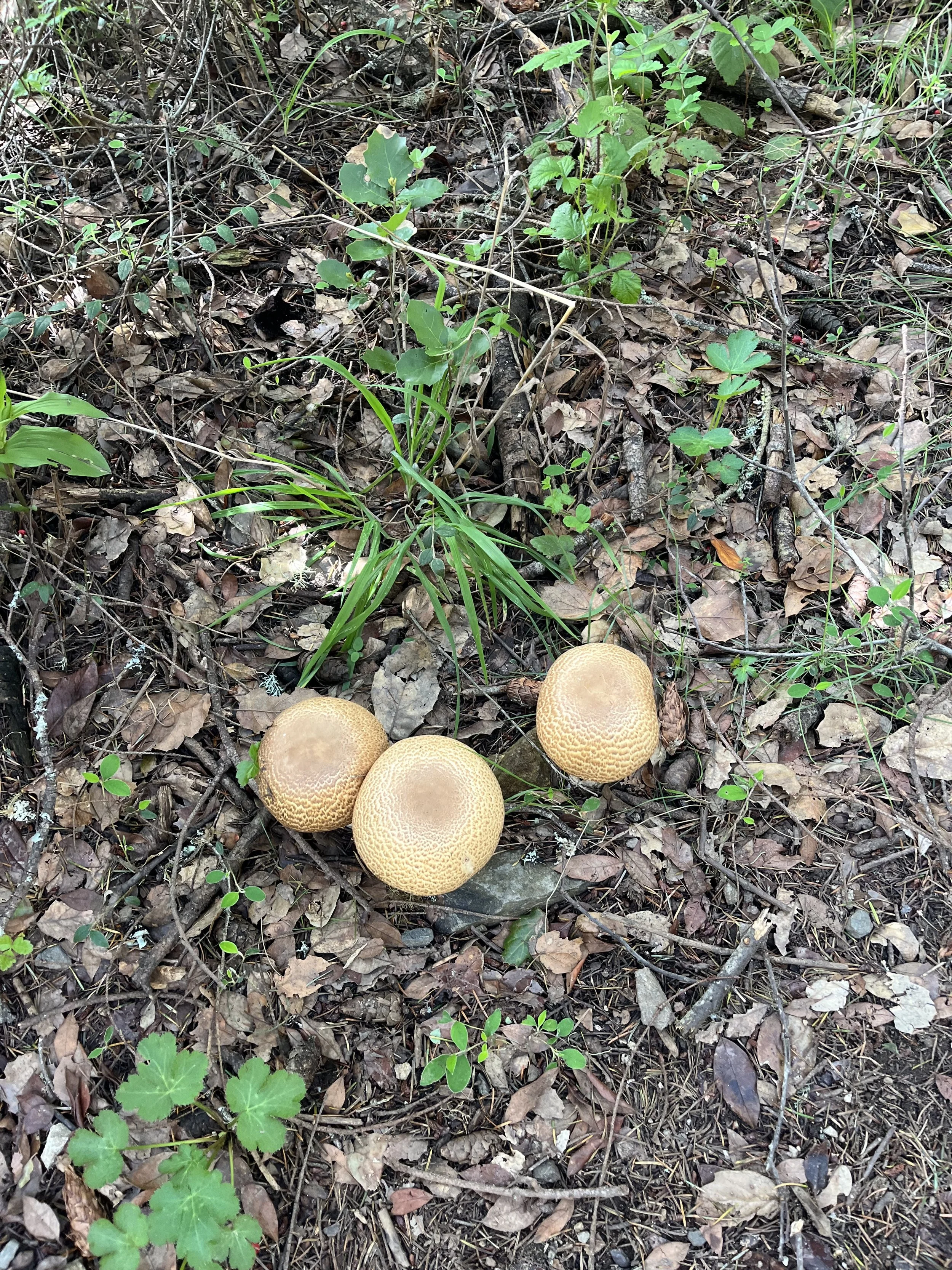
After a while, the wide gravel path turned into a dirt trail, and we continued up beneath the dappled shade provided by Douglas Firs. I stopped when I spotted some large mushrooms, and we turned one over, pressing down on the gills beneath its cap.
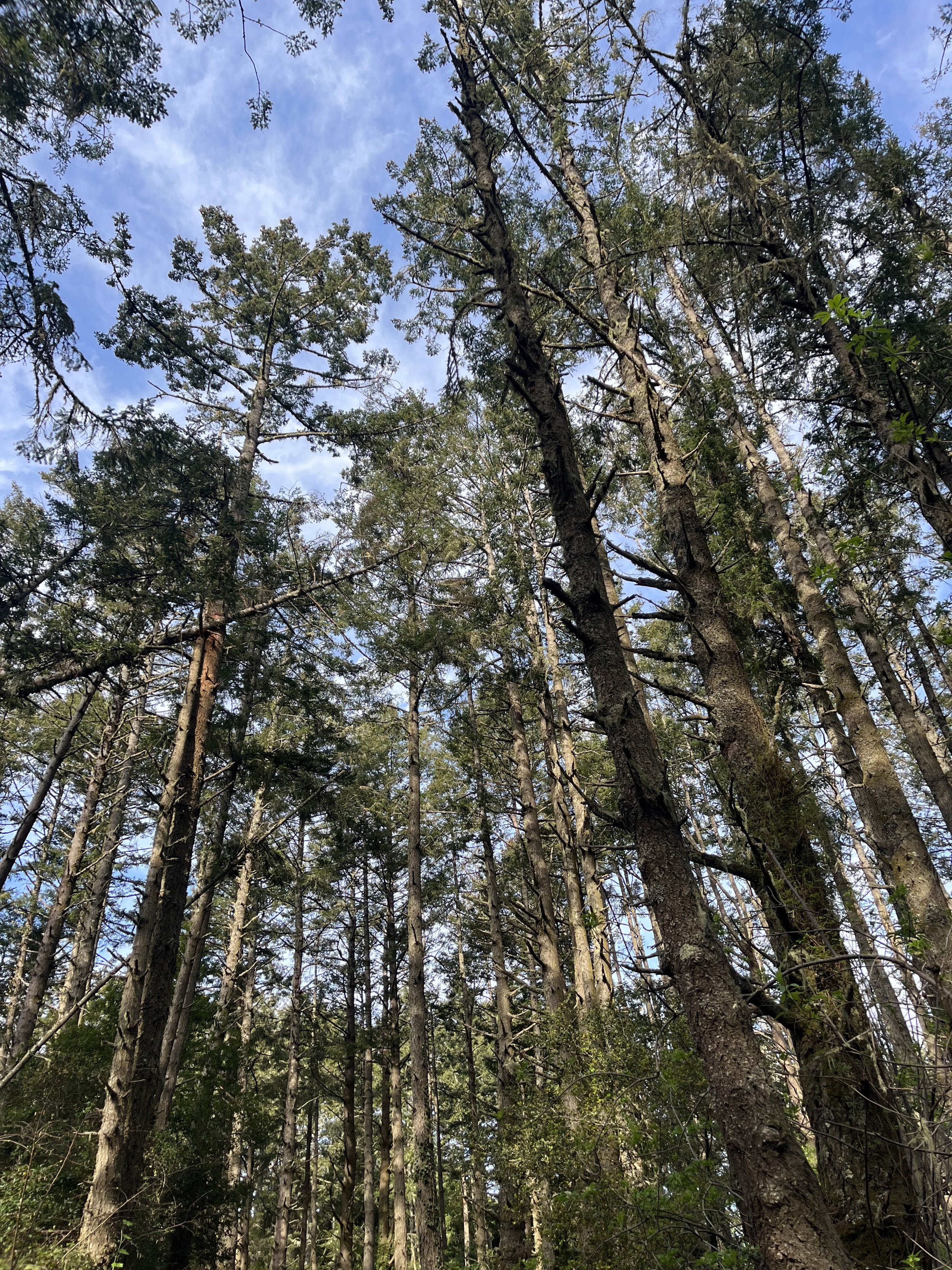
It was a continuous ascent up the dirt path, and after a while, we emerged from beneath the Douglas Firs near the top of the peak, where mostly shrubbery poked from the red earth.
Sweat made my shirt cling to my back, pressed and made sweatier by the small red backpack I’d worn. I was too afraid to remove my hat, given the hat hair I was sure to have, so I flipped it around a few times based on when we were in the sun (brim forward) and when we were walking beneath the trees.
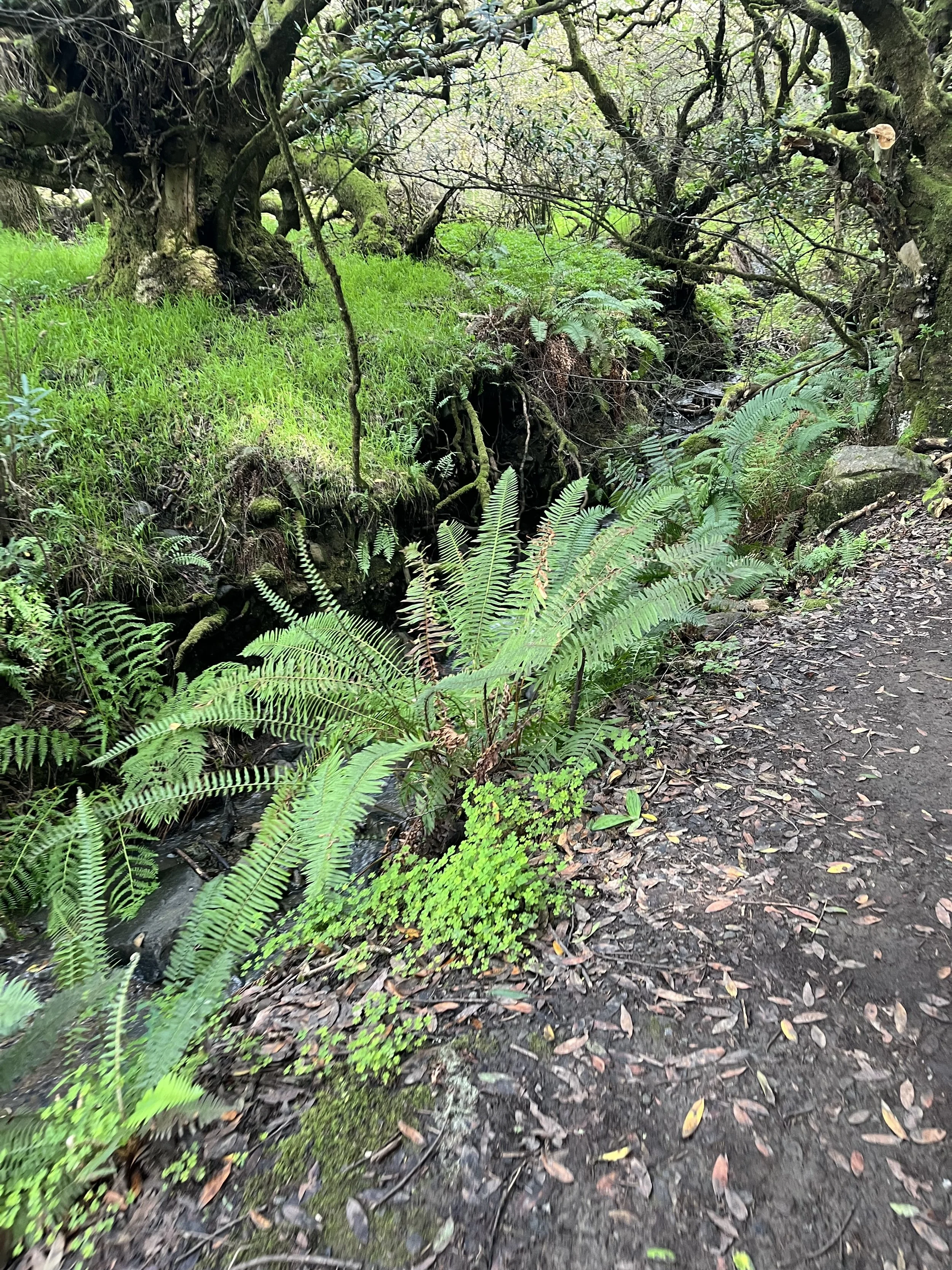
We re-entered another woodland zone and hiked past trees that had fallen and were now velvet with moss. Ivy crawled up trunks on those that stood tall, and the giant roots of other fallen friends marked the side of the path we climbed.
Break time at the top of the mountain
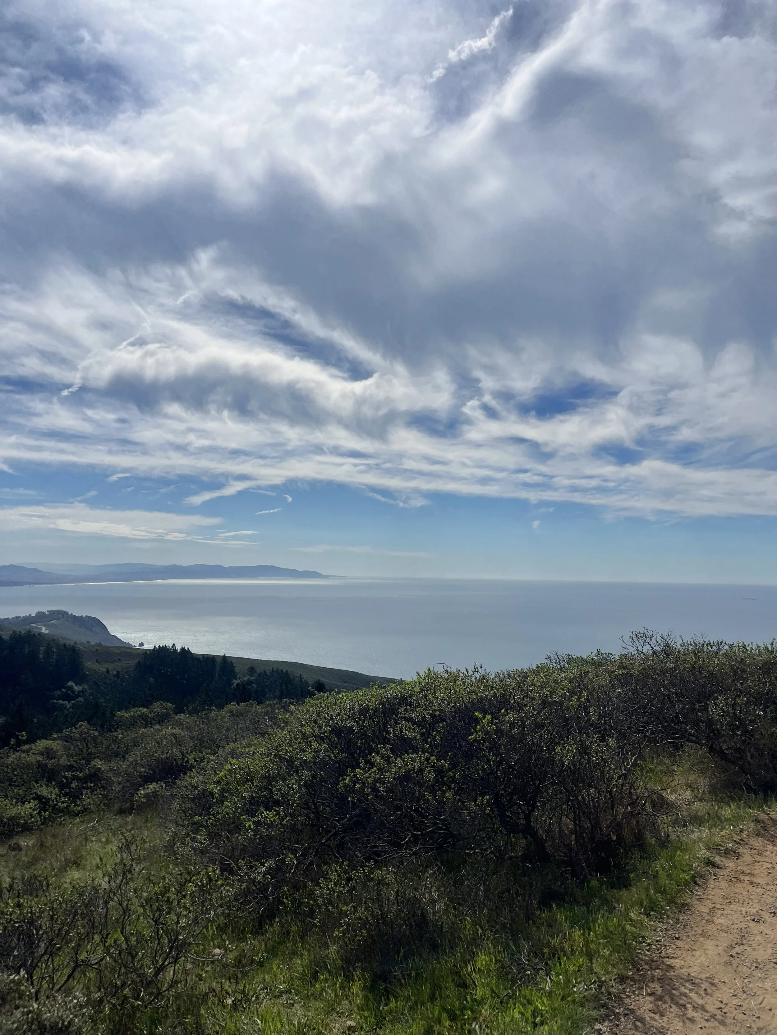
When we once again found ourselves out of the woods and into open air, we were at the top of one of the peaks. There was a clear view of the ocean from this point, and we were happy to see a water refill station.
We took turns refilling our water bottles and pulled out some trail mix for a quick snack break. After gazing down toward the sea, green hillsides carved into the watery vista and blue edges of land in the distance, we were ready to set out once more toward the ocean on the other side of us. One that we could not see.
We were about three miles in at this point and had another four or so until we reached the beach.
We spent the next few hours winding our way past redwoods and birch, staring up as ivy danced around trunks, and catching glimpses of the ocean now and again.
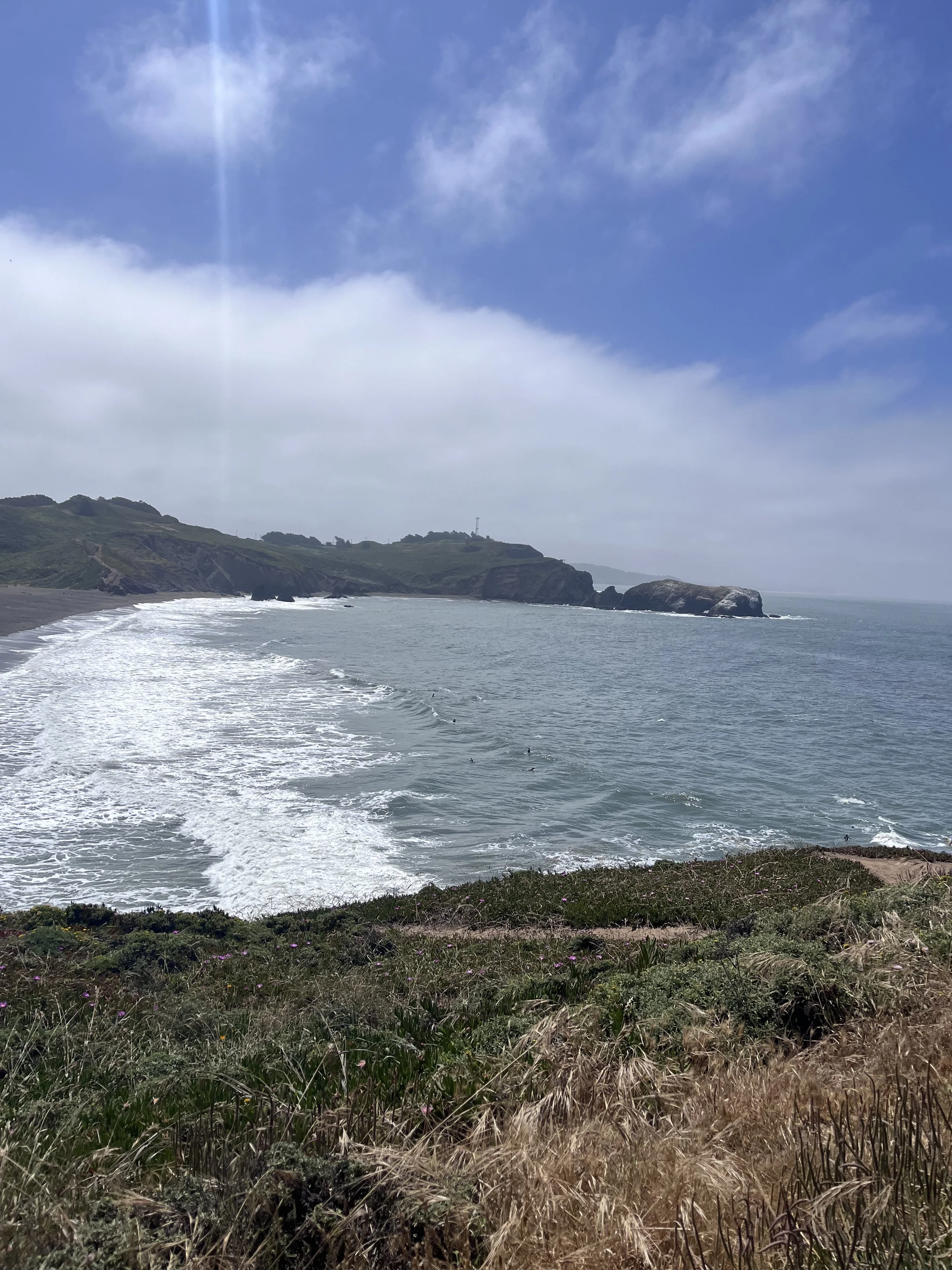
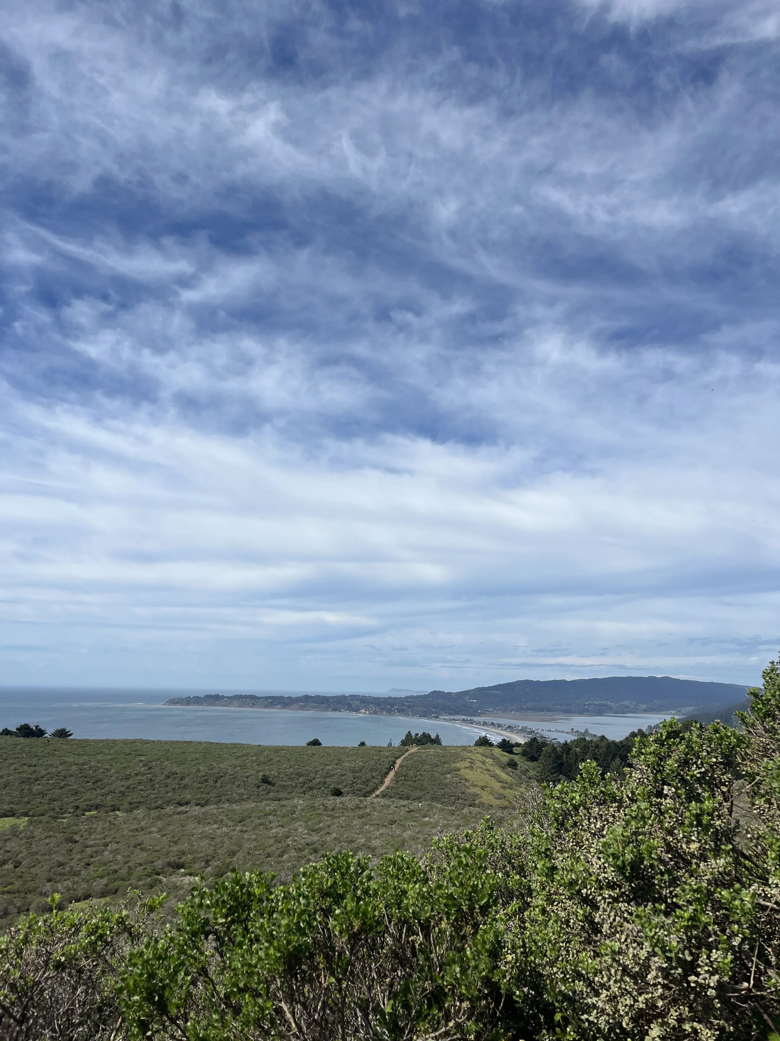
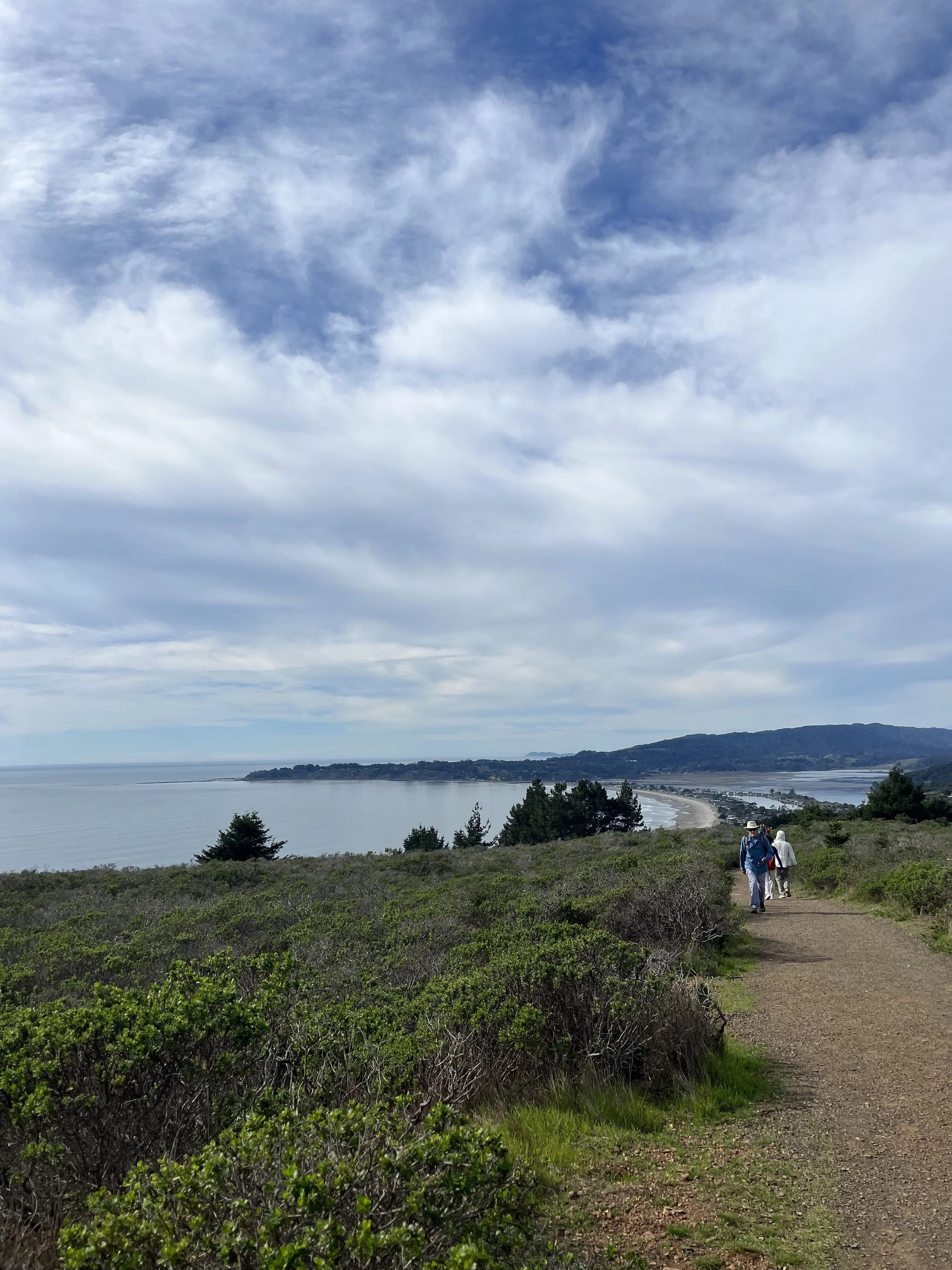
Finally, we emerged from the trees once more to trek across a narrow, dun-colored dirt trail that provided views of Stinson Beach.


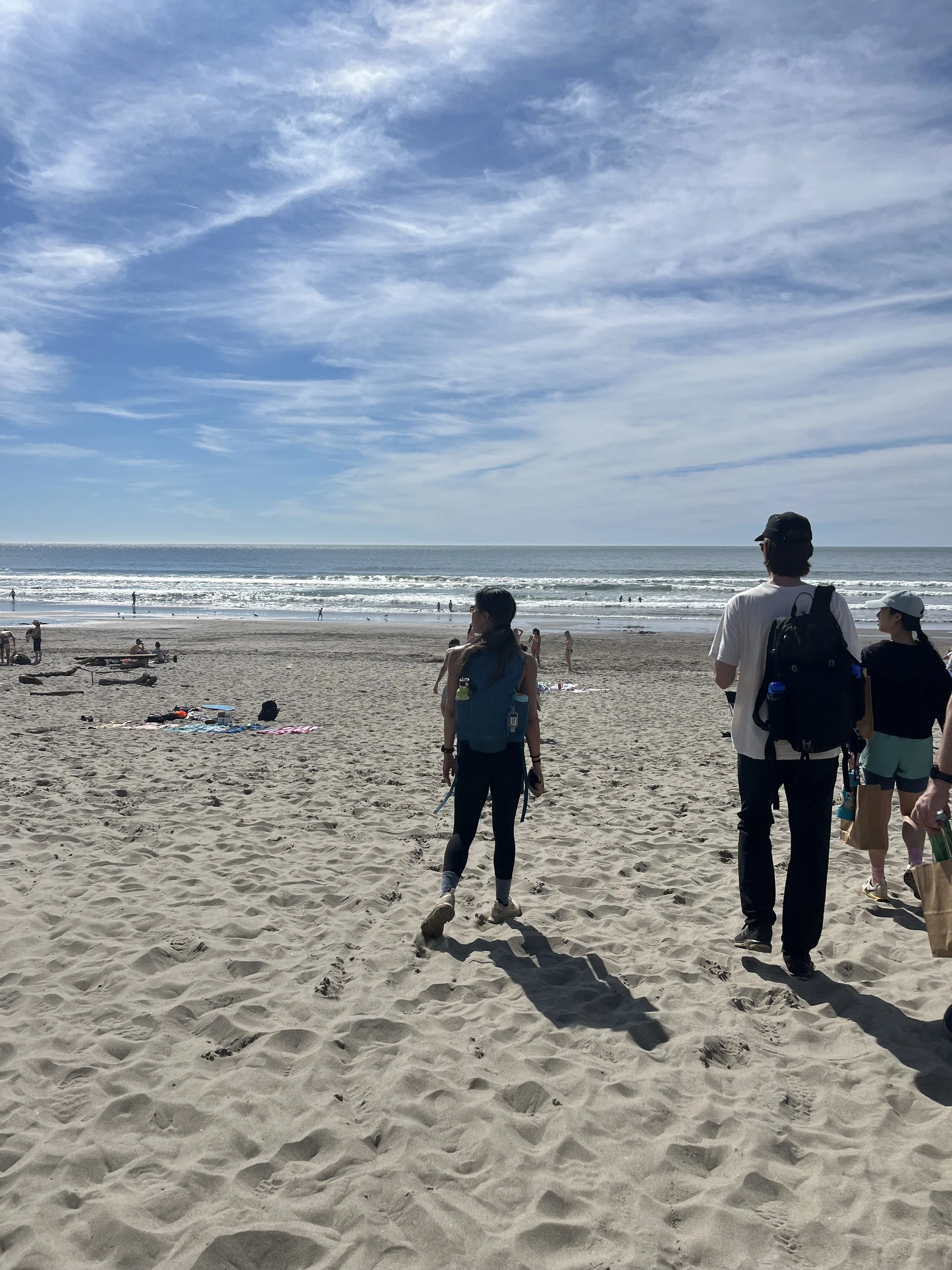
Lunch at Stinson Beach
It takes a while to traverse that dun-colored path and then descend into the small beach town near Stinson Beach. At this point, I was tired, hungry, and over-caffeinated after coffee and too much pre-workout.
We stopped for a bit to provide two other hikers some sunscreen, then skedaddled toward the food.
There is a restaurant, a market, a bakery window, and a snack bar window that you can order from once you’ve arrived in town. It all reminded me of my childhood, summers spent near the beach in Hawaii and San Diego, hungry and sweaty and ready to devour something salty and fatty.
I saw a pesto pizza that looked like what dreams are made of in the window of the bakery, so I got in line to order a slice. Others in the group got in line for the snack bar.
Biggest mistake of my life.
I almost cried when the person in front of me ordered the last three slices… The man behind the window didn’t flinch as he told me they would not be making any more, and was lacksidaisical when he said there were no more vegetarian sandwiches left either.
Turning away, I walked to the small market around the corner and bought three salads and a pastry to make up for my missing pie.
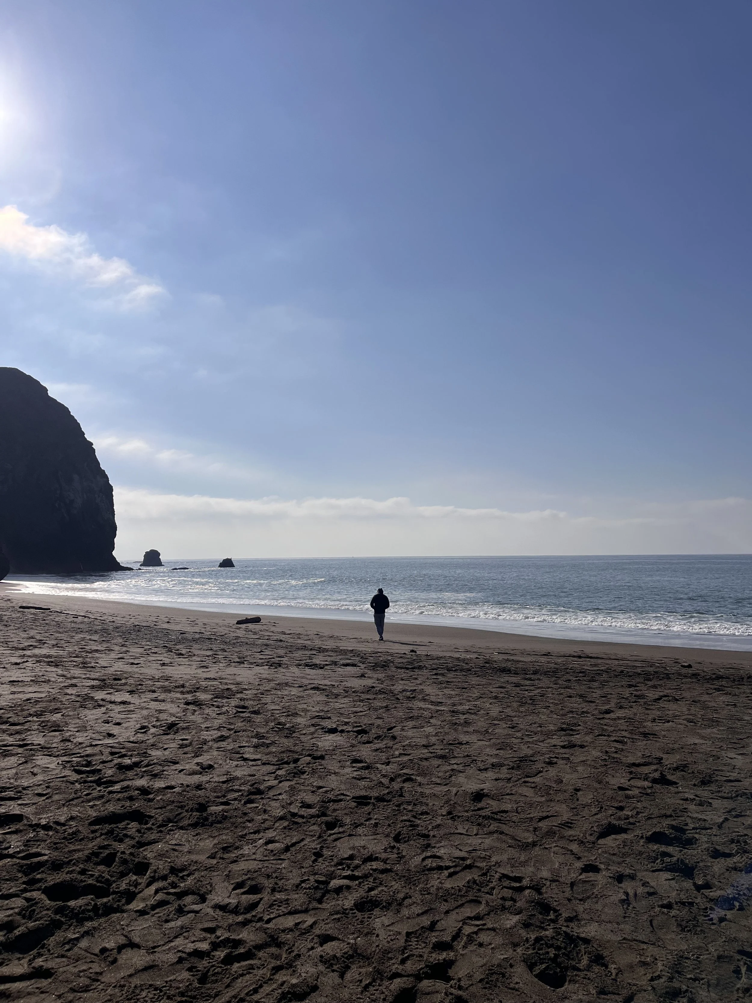
After everyone received their orders, we walked down toward the beach. We crossed through a small beach park with picnic tables and another water refill station, then found a spot on the sand.
Waves crashed, white foam curling over the edge of shaped faces, and a few surfers caught the shorebreak. It was low tide, and it must have been scary to catch waves in water that shallow. We watched as people walked out from the shore all the way to where the waves were forming, their torsos still above the water line.
It was fun to see the teenagers and families at the beach. Things haven’t changed much from my own teenage years, and we’re pretty sure we saw a sixteen-year-old sipping a Coors Light while philosophizing with his buddy about life.
I’m not going to pretend it was easy, after we’d finished our food and used the bathroom, to start our journey back to our cars. Just another six or seven miles.
Choosing a new path on the way back
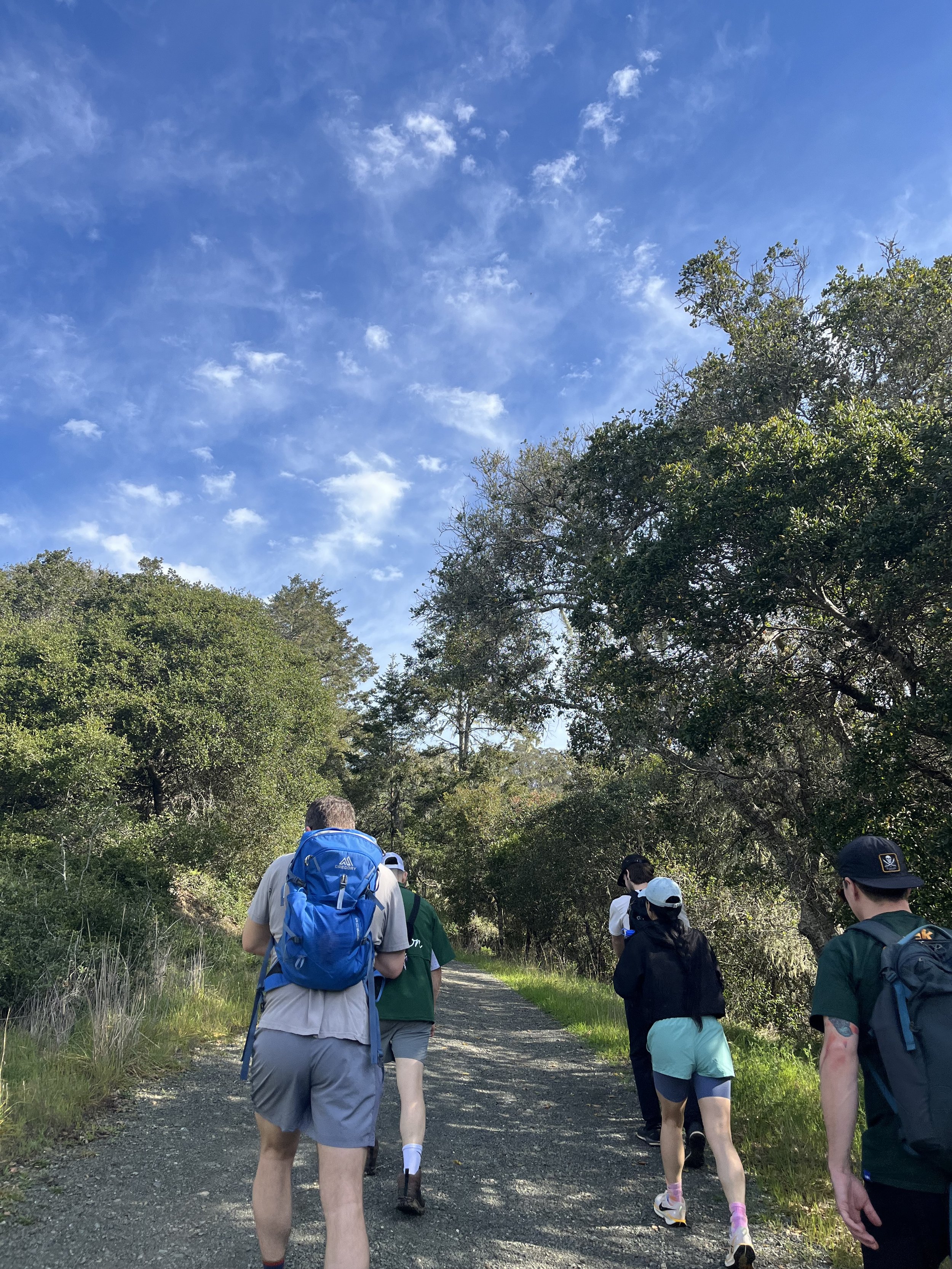
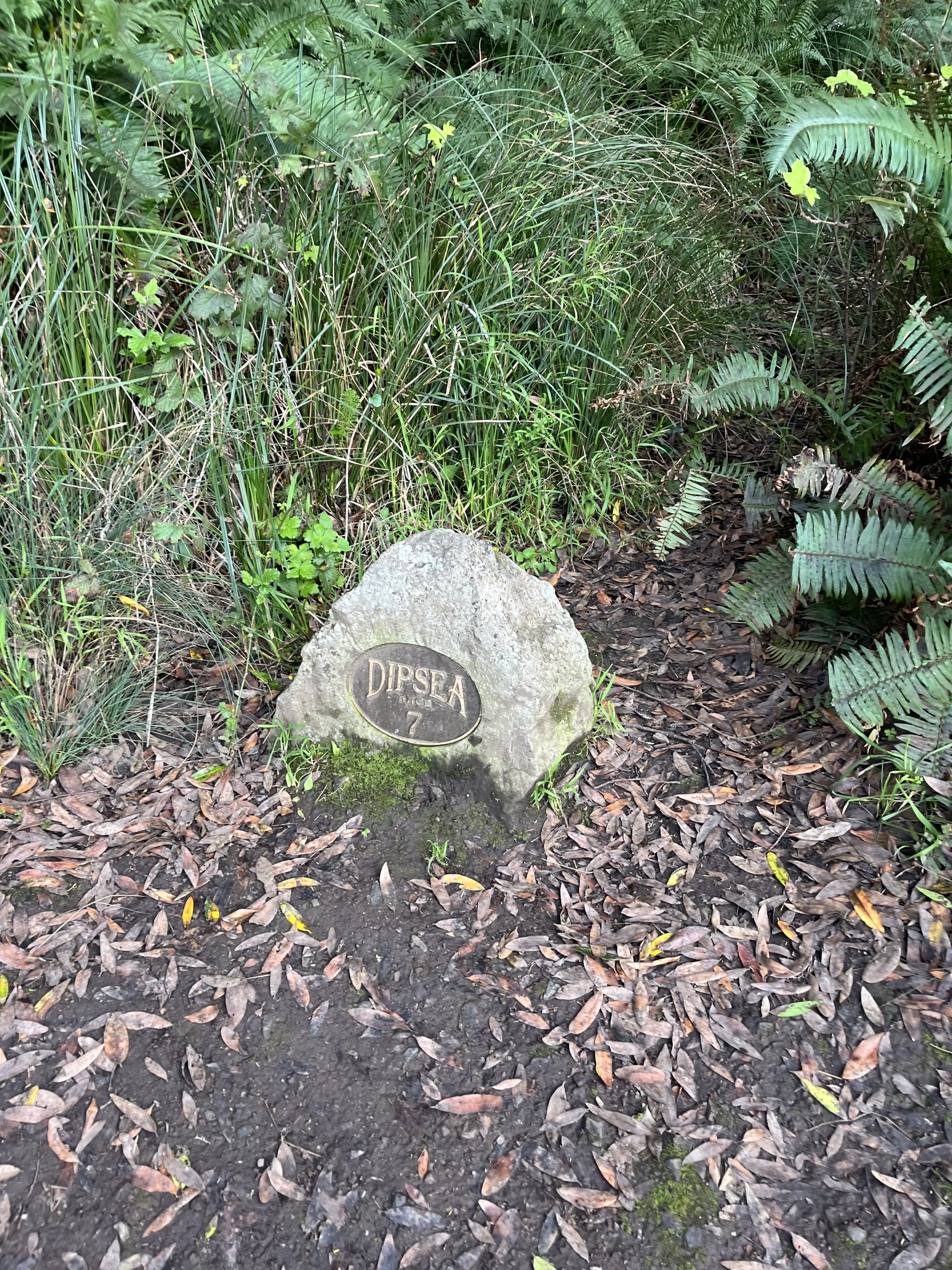
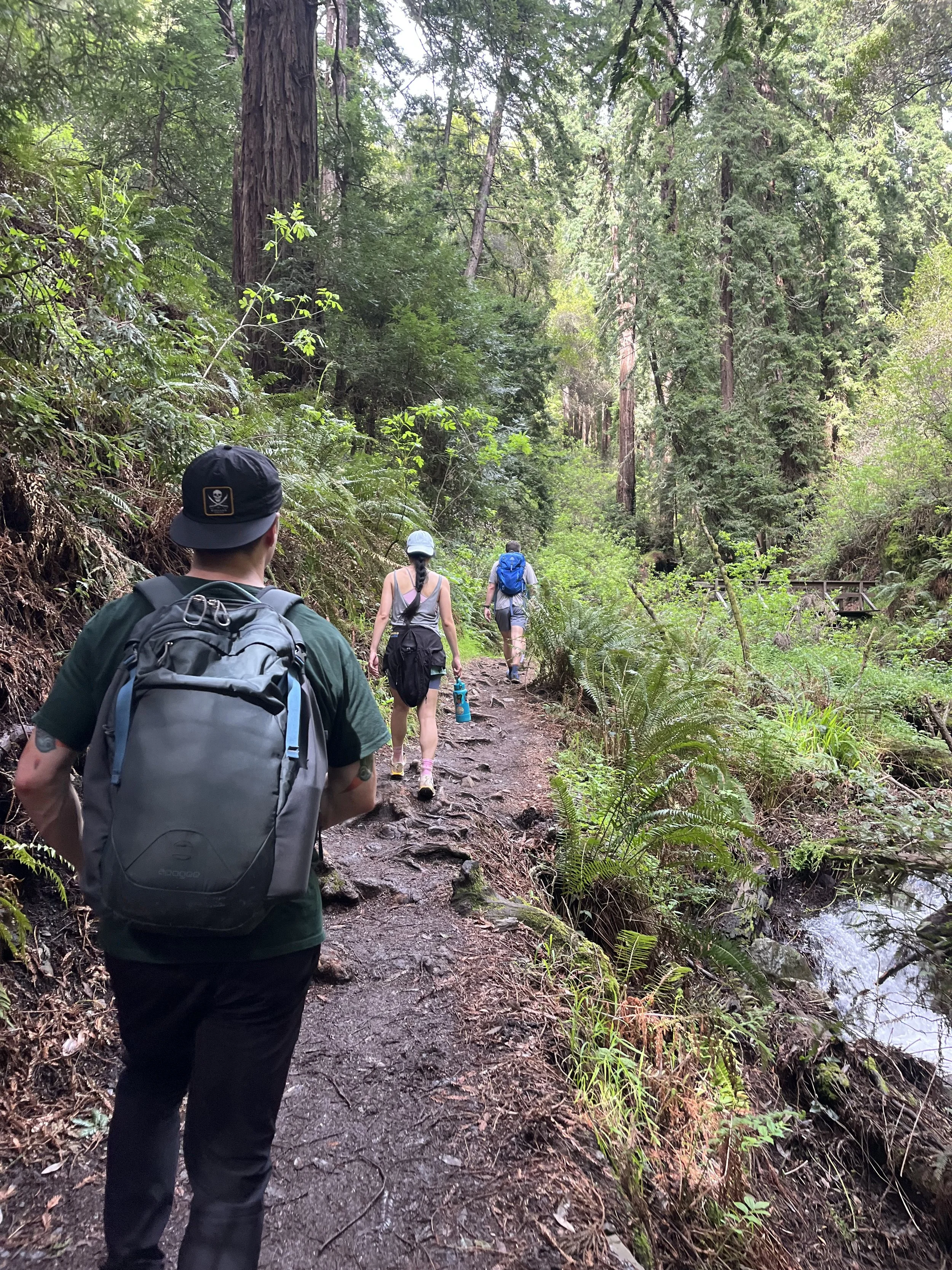
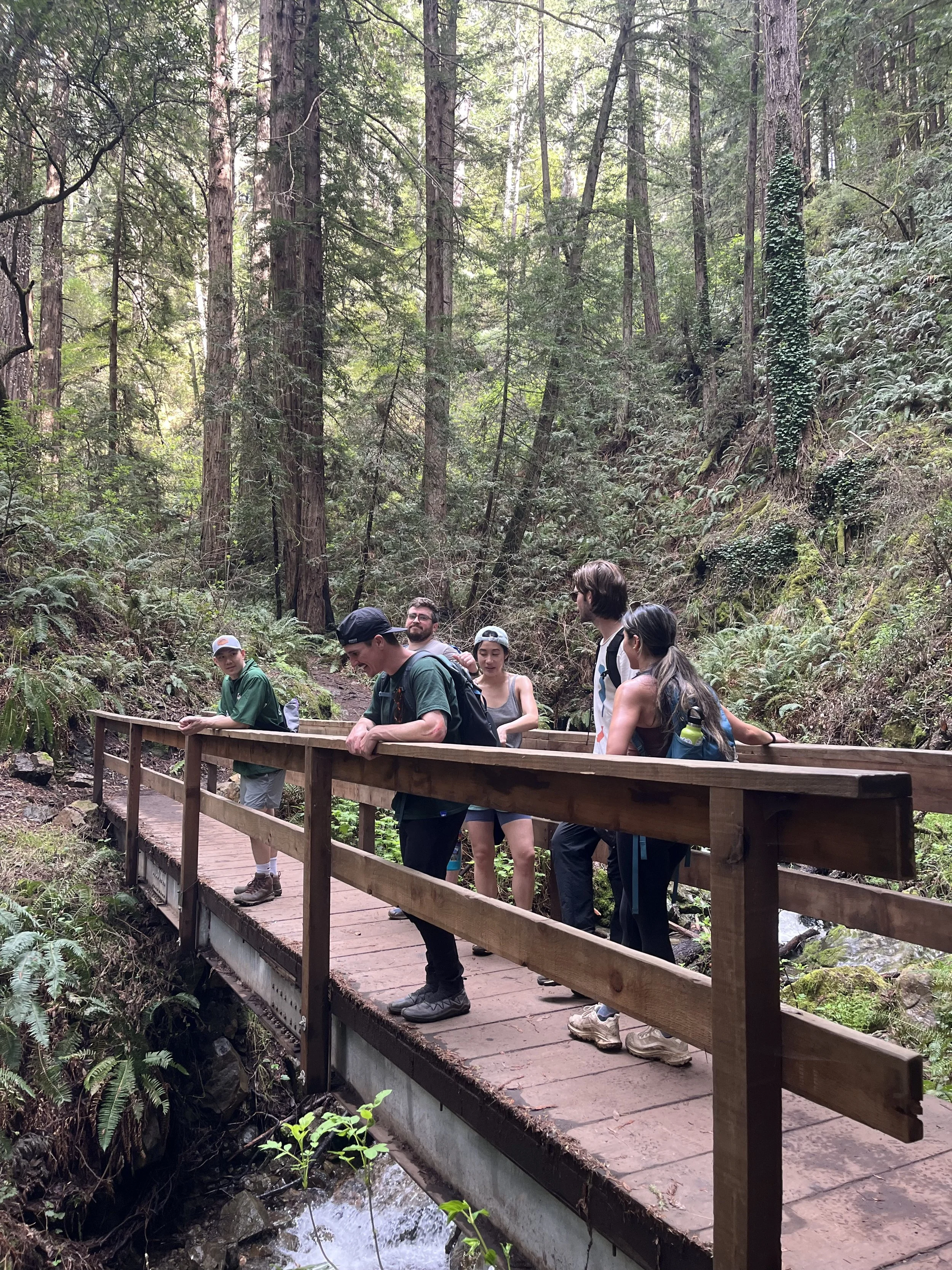
Our fearless leader, who had downloaded the map on AllTrails, recommended we take another path back. I often prefer a loop rather than an out-and-back because the novelty of new sights helps me feel less tired. We followed the same warm trail up from the beach, but then turned to take a much lusher route through deep redwoods.
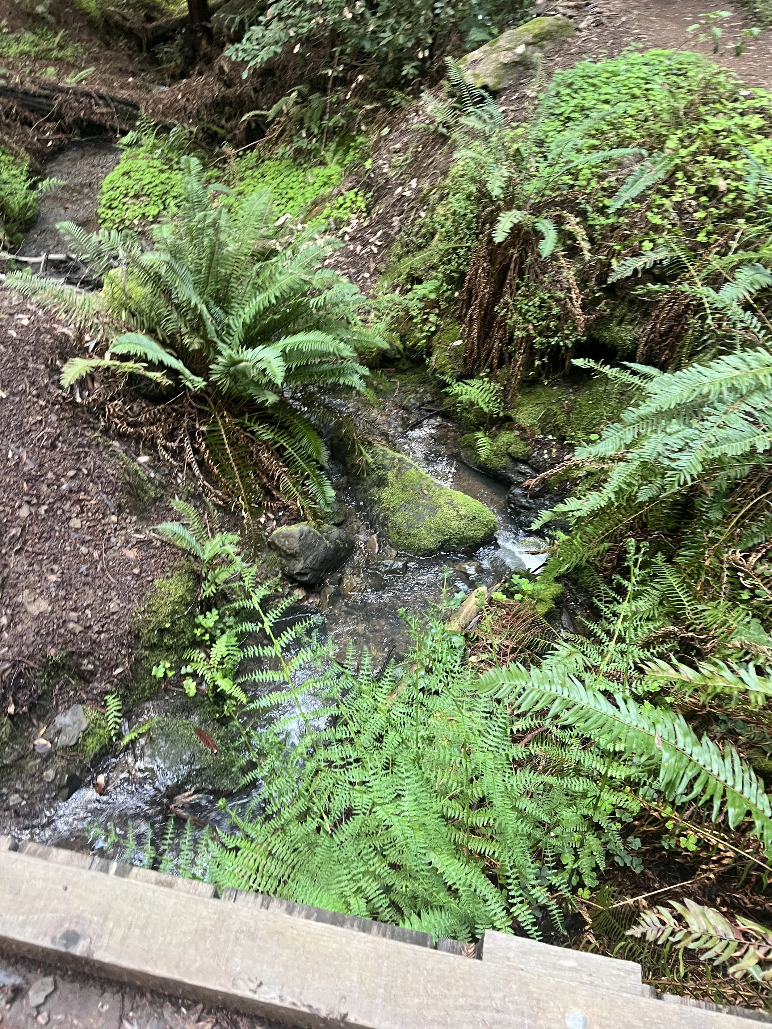
This was such a great choice. I love trails that are surrounded by our coastal redwoods and where water runs in thick streams along the way.
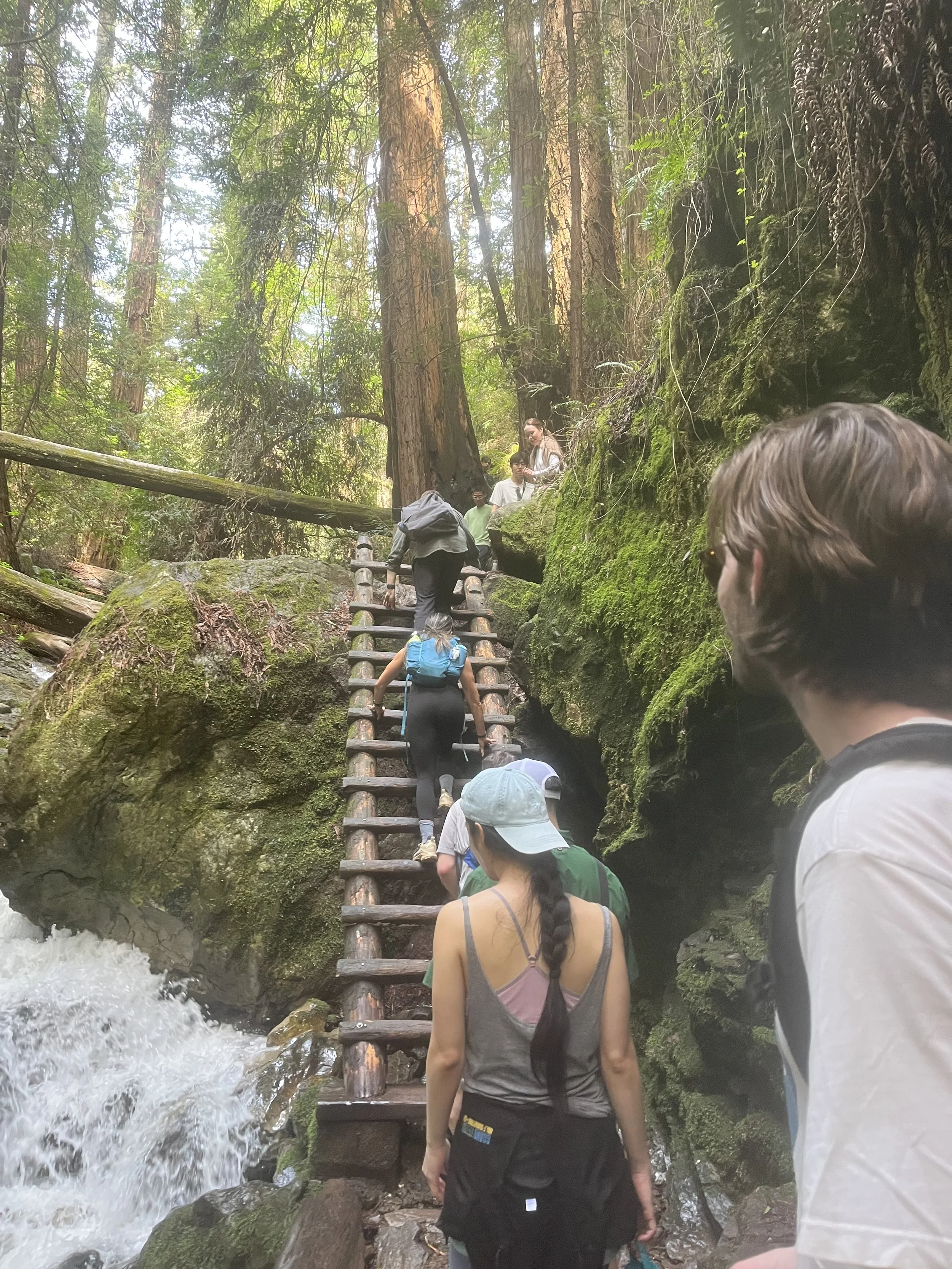
It also included a climb up an old ladder that, as we discovered, is very “Instagram-worthy.”
I find it hard to be annoyed when I see someone really excited to try something, especially when it’s out in nature, so even though it took extra time for people to film each other climbing on the ladder, I didn’t mind the wait. However, I can see this becoming a huge issue if there is a bigger crowd. It’s the only way to continue on the trail, so I encourage everyone to be quick and efficient rather than stall for a full photoshoot.
After walking along the trails, shielded by the heavy trees and surrounded by the hypnotic lattice of greens—ferns, grasses, wild weeds—we exited onto a road. There, we found another bathroom and yet another water refill station.
This was great because we did, in fact, all need more water.
Other hikers were stopped there as well, resting their legs or just beginning their journeys. There was a small area for cars to park, and a trailhead that started from that spot.
When all of our water bottles had been refilled, it was time to get back onto the trail and make our way down to Muir Woods.
Rat Island in the San Francisco Bay
We emerged from the forested area and once again walked along an open path where we could see out into the bay.
“You guys know about Rat Island?” My boyfriend asked.
None of the rest of us had ever heard of it, and he launched into an explanation of an island that had a rat infestation, which had depleted all the natural flora and fauna that had been there previously.
Apparently, since then, the rats have been erradicated. The island is thriving once more!
There’s a Reddit thread about it, I guess.
Praying for lost souls on hikes
One of the most memorable parts of the hike had nothing to do with the hike itself. We ended up coming across a young man who’d been with a big hiking group (we’d seen them at Stinson Beach), but had somehow gotten separated from them.
I’m not sure if he was just panicked and overwhelmed, or very high, but he was confused about where to go. Our friend with the map opened it to show him where we were. At first, we thought he was trying to get back to Muir Woods (the same as us). It was difficult to figure out where he was trying to go because he just kept repeating, “I’m supposed to be on a loop trail.”
It was only after he’d been hiking near us for a while that we realized he was trying to get back to Stinson Beach.
We pointed him back the way we’d come, told him to look for the signs (they are pretty clearly marked with “Stinson Beach”). There were still a lot of people behind us on the trail, and we told him to keep asking people to point him in the right direction of the beach.
I hope that experience doesn’t deter him from going out in nature again.
Muir Woods National Monument
The way back included a long descent, switchbacks winding over roots and rocks. It was suddenly cold from sweat in the shade of the redwoods. I’m not going to lie, after ten or so miles, my knees tend to betray me, and the downhill portion was not as easy as I expected it to be.
Still, it was beautiful beneath the trees and surrounded by ferns. We crossed wooden bridges that had been built over streams and listened to the hushed whispers of the water moving over the land.
When we reached the bottom of the switchbacks, we were in Muir Woods, and it felt good to be on flat ground.
One of my favorite parts about many National Parks is that they are accessible. Wide, flat paths that allow people of all ages and mobility to enjoy the experience. As we made our way out through the park, there were areas of quiet and areas where children giggled and raced, learning to love what these natural places provide from a young age.
I once stopped to talk to an environmental researcher who was taking water samples in the streams of Muir Woods to ask about the Coho Salmon. I always think of that when I return there, hoping for better conditions for Salmon brother.

We exited the park, but not before stopping at the gift shop, where we found booklets that help you learn about the types of fish that are most sustainable to eat in California.
Then it was a short walk back to the car and a well-enjoyed seated ride back across the red-lined bridge.
Sometimes, when I’m hiking something a challenging trail, I can’t tell if I’m enjoying myself. It’s only afterward, when I have time to reflect on it, that I realize how special and magical it was.
The same is true for the Dipsea Trail.
What a perfect day it was.