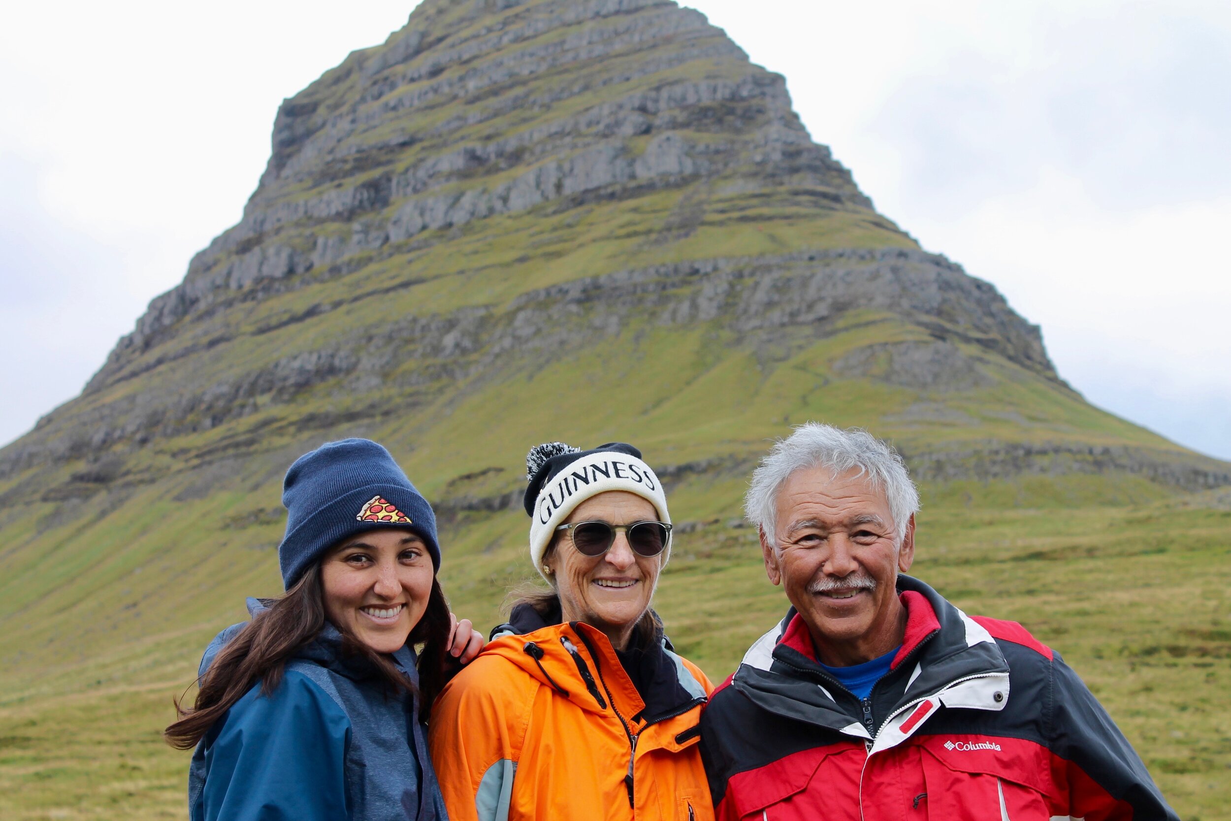
Our Travels to Iceland: Day 2 Snaefellsnes Peninsula
We awoke in our little pink and green cottage and made our way down the narrow, steep stairs to the kitchen. There, I sipped greedily at a cup of coffee and poured myself a bowl of Museli mixed with lactose-free blueberry yogurt and some peanut butter.
Once we were all sufficiently fed and caffeinated, we prepped small sandwiches for the road and I cut up some bell peppers and cucumbers to go with some humus as a car snack. Then, we packed our daypacks and headed out the door.
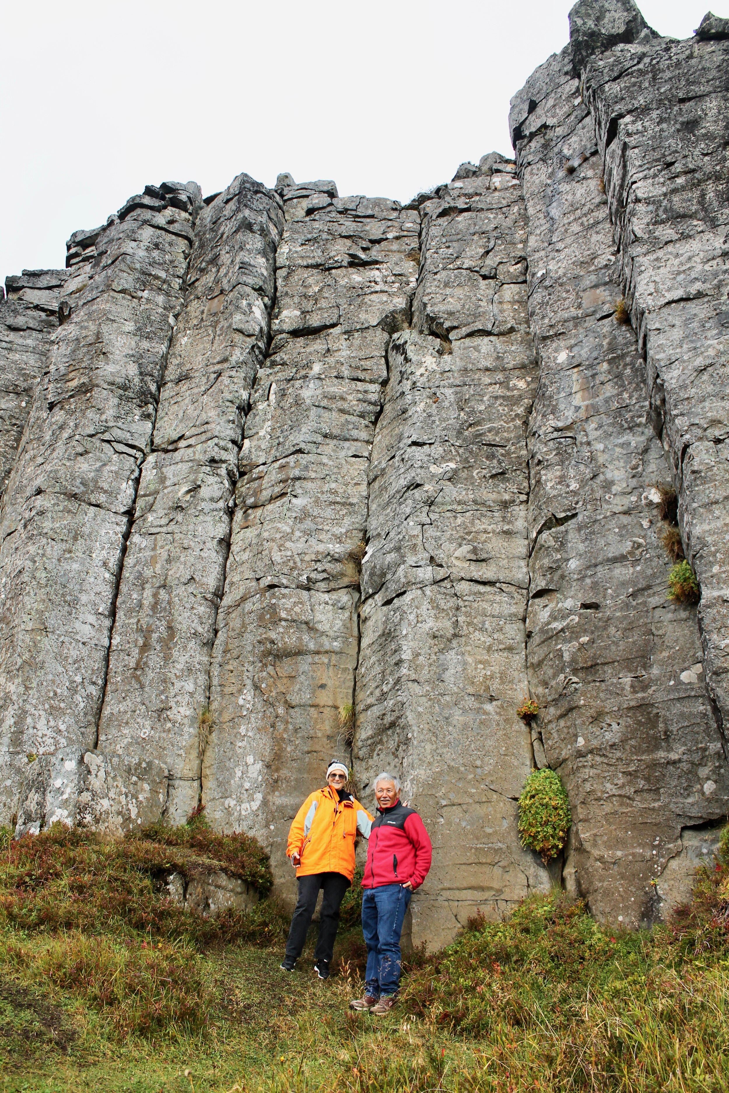
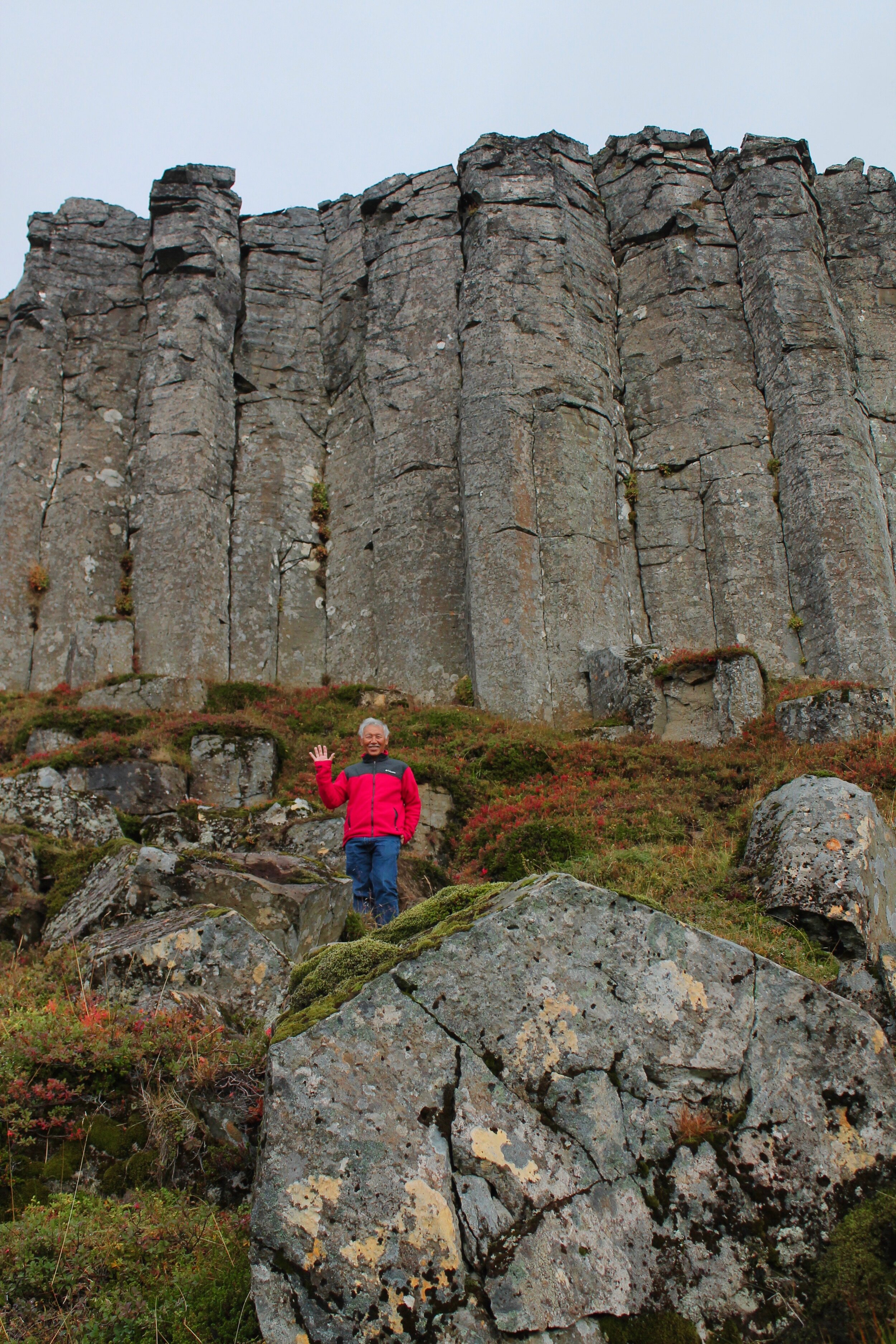
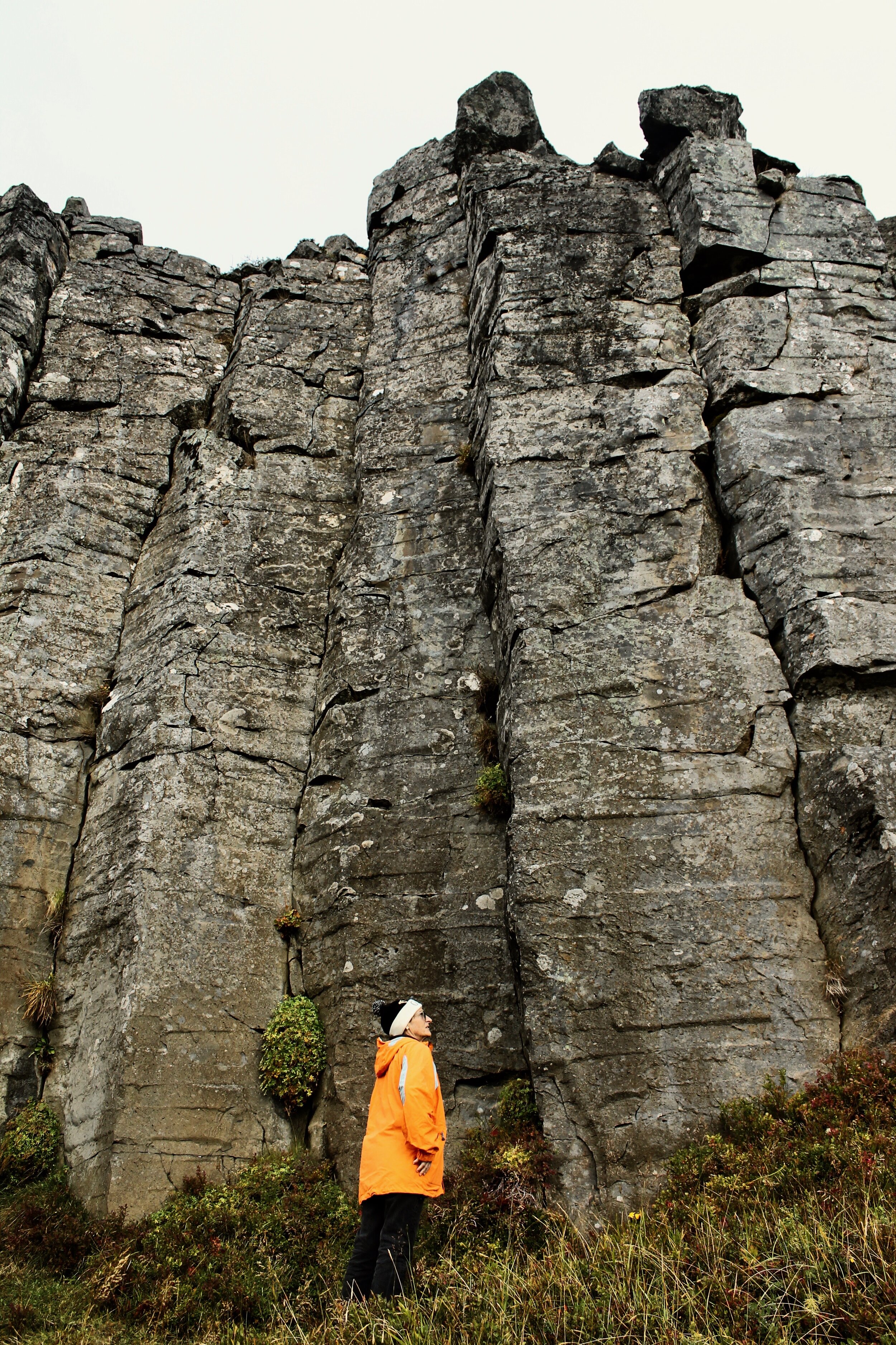
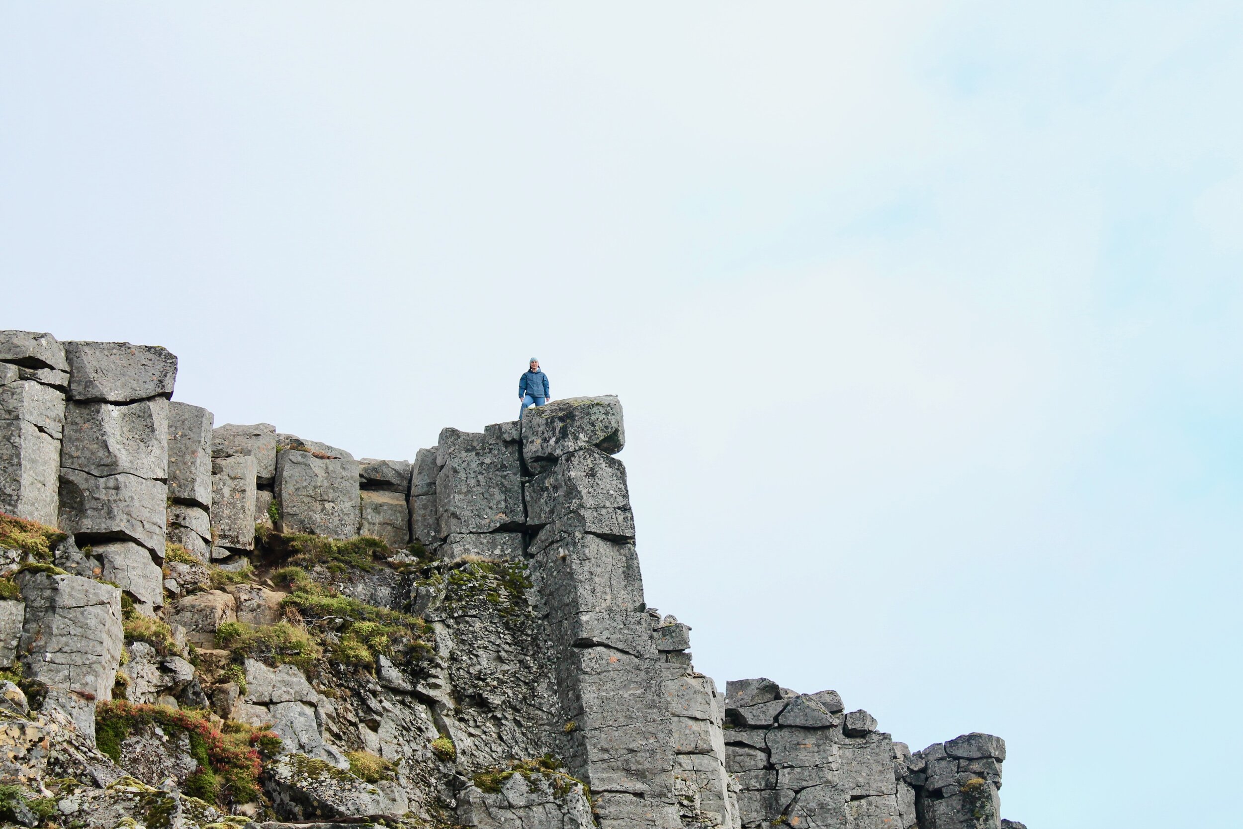
Snaefellsnes Peninsula Stop #1: Ger∂uburg cliffs
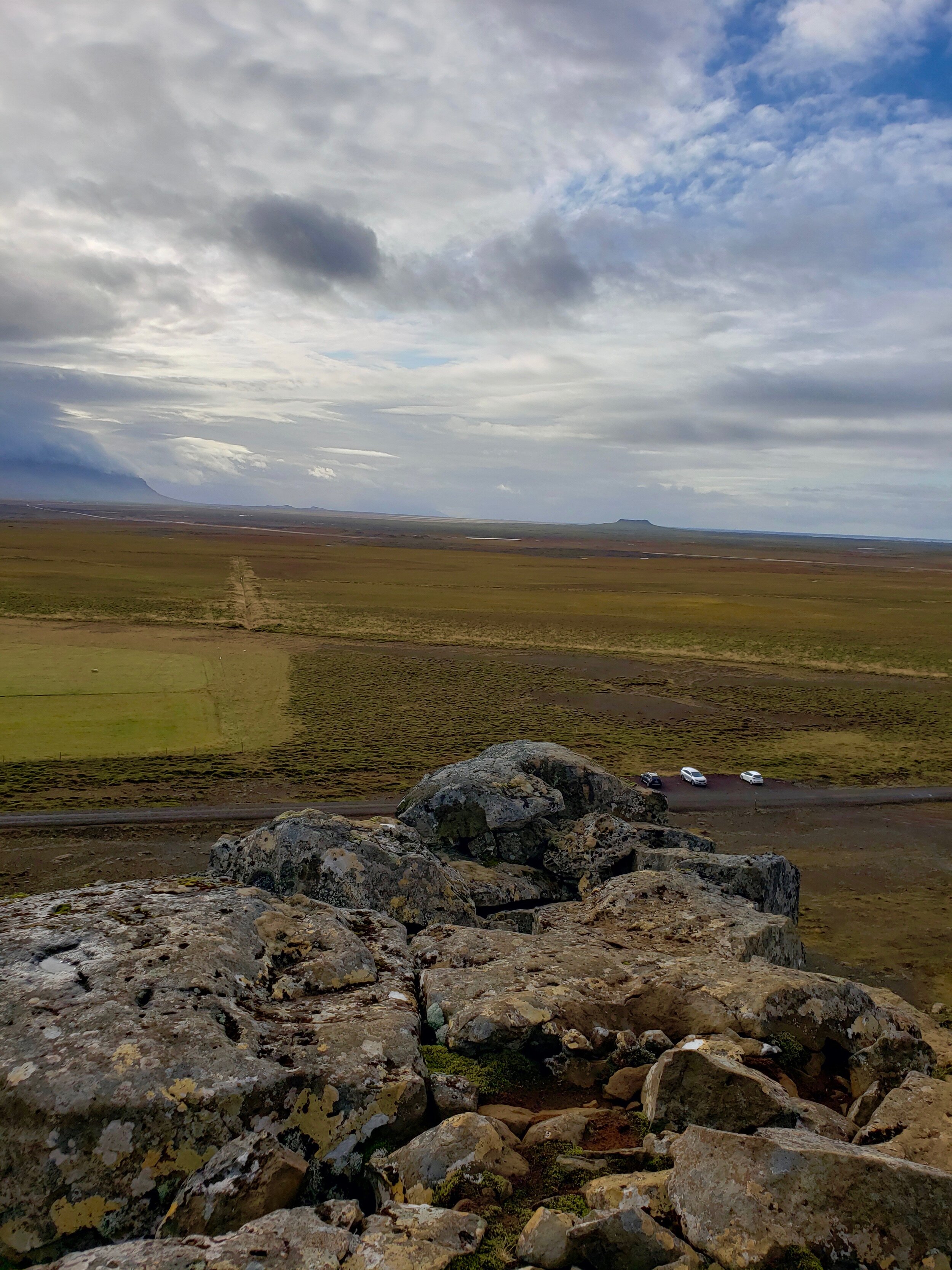
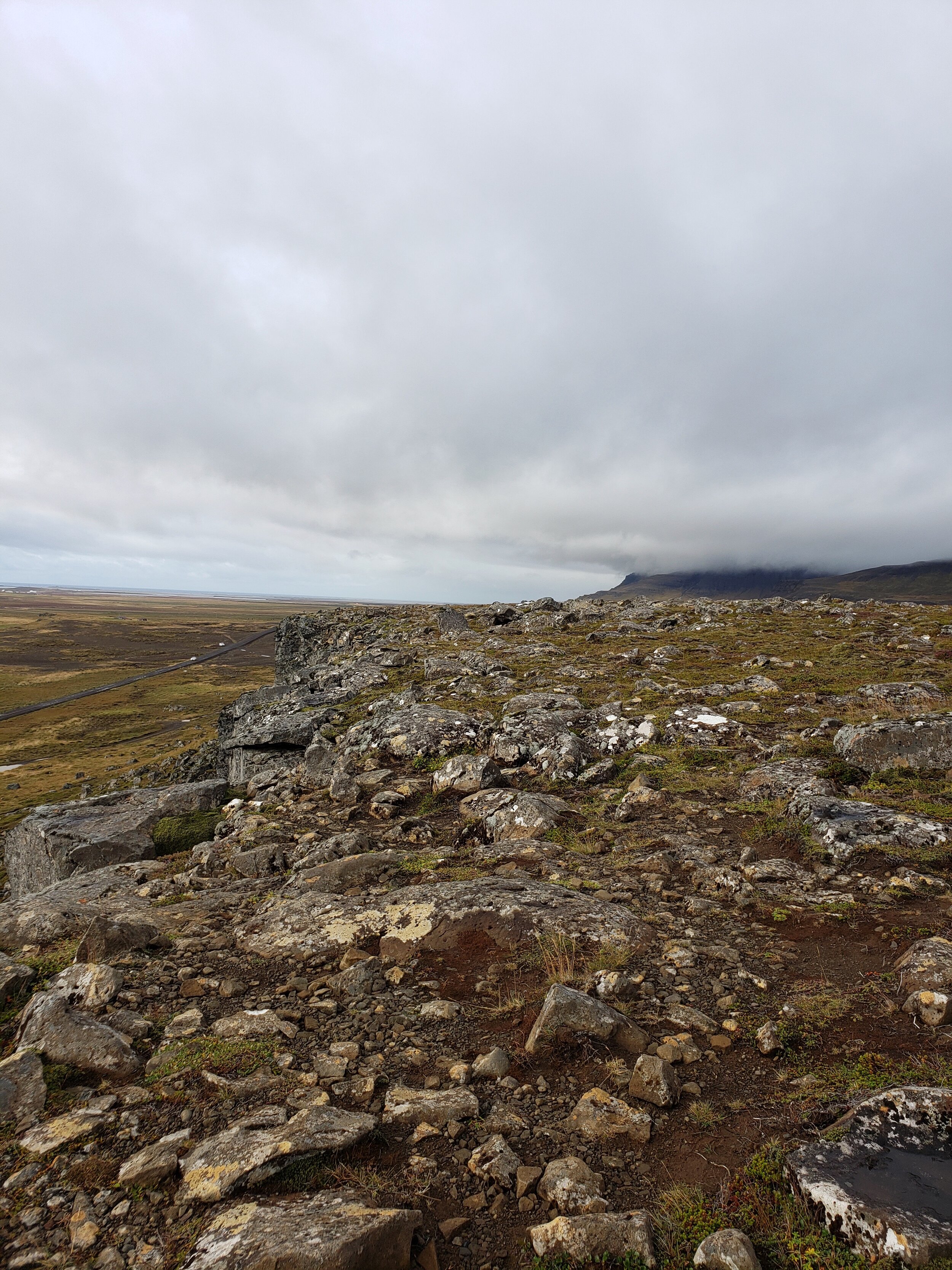
From Stykkishólmur, we drove for about 40 minutes down the long winding path of the Snaefellsnesvegur road until we took a left up a gravel path. It, in turn, wound to the right until we were at the base of the rectangular basalt columns that are the Ger∂uburg cliffs.
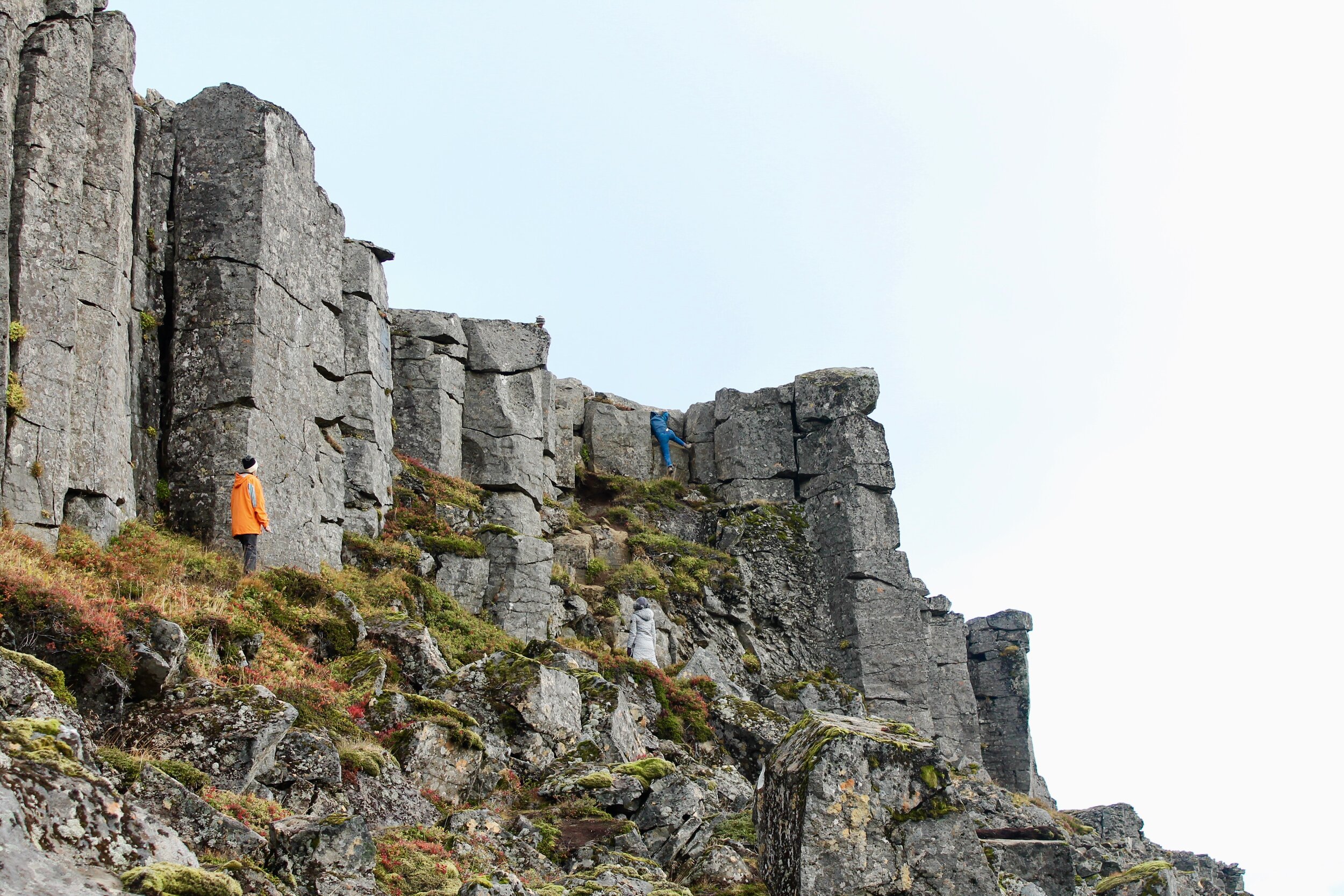
Getting out of the car, we walked up toward the columns so that we could stare up at their vertical faces. I made my way to the right to climb up to the top using a couple of ledges. Of course, I am not the best climber in the world and had to be helped by a nice Russian man who showed me where to hold the rock in order to pull myself up.
“I have extremely short legs,” I explained to him.
“Really?” He asked in a way that made me wish that I hadn’t just said that out loud.
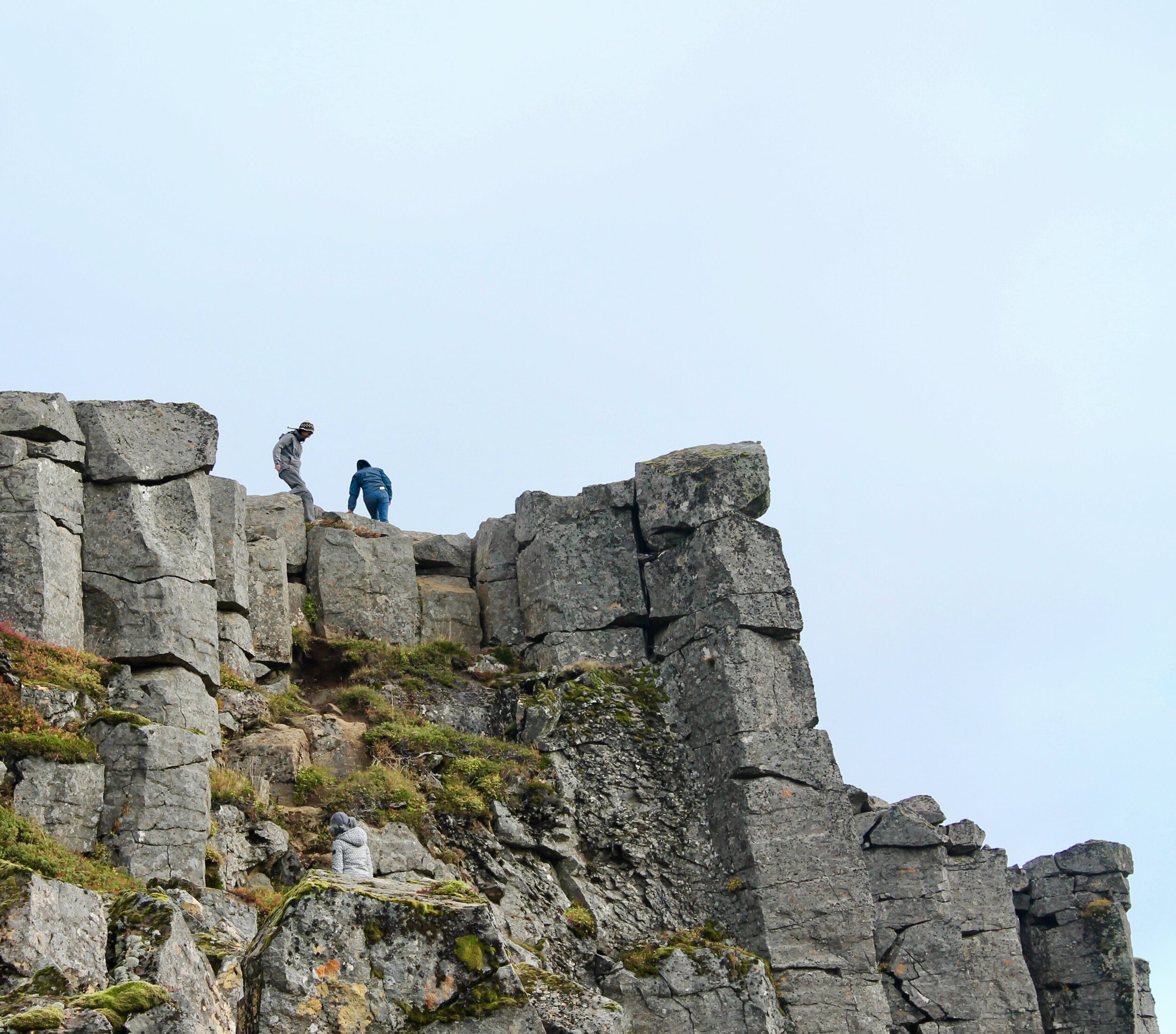
With dirt on the knees of my Levi wedgies and on the palms of my hands, I found myself standing on the top of the rocky, carved columns. There, I discovered that the cliffs were actually the face of a large plateau.
“Your queen of the mountain now,” said the Russian man as he hopped effortlessly down to meet his wife and head back to his car and family.
I wandered around for a while and looked out over the expansive view. It was incredibly how far you could see from the top. Down to the road and beyond to large volcanic mountains that rose from the earth. What I love most about Iceland is how wild it still seems. How you can imagine elves still existing in the crevices of the surrounding lava and moss.
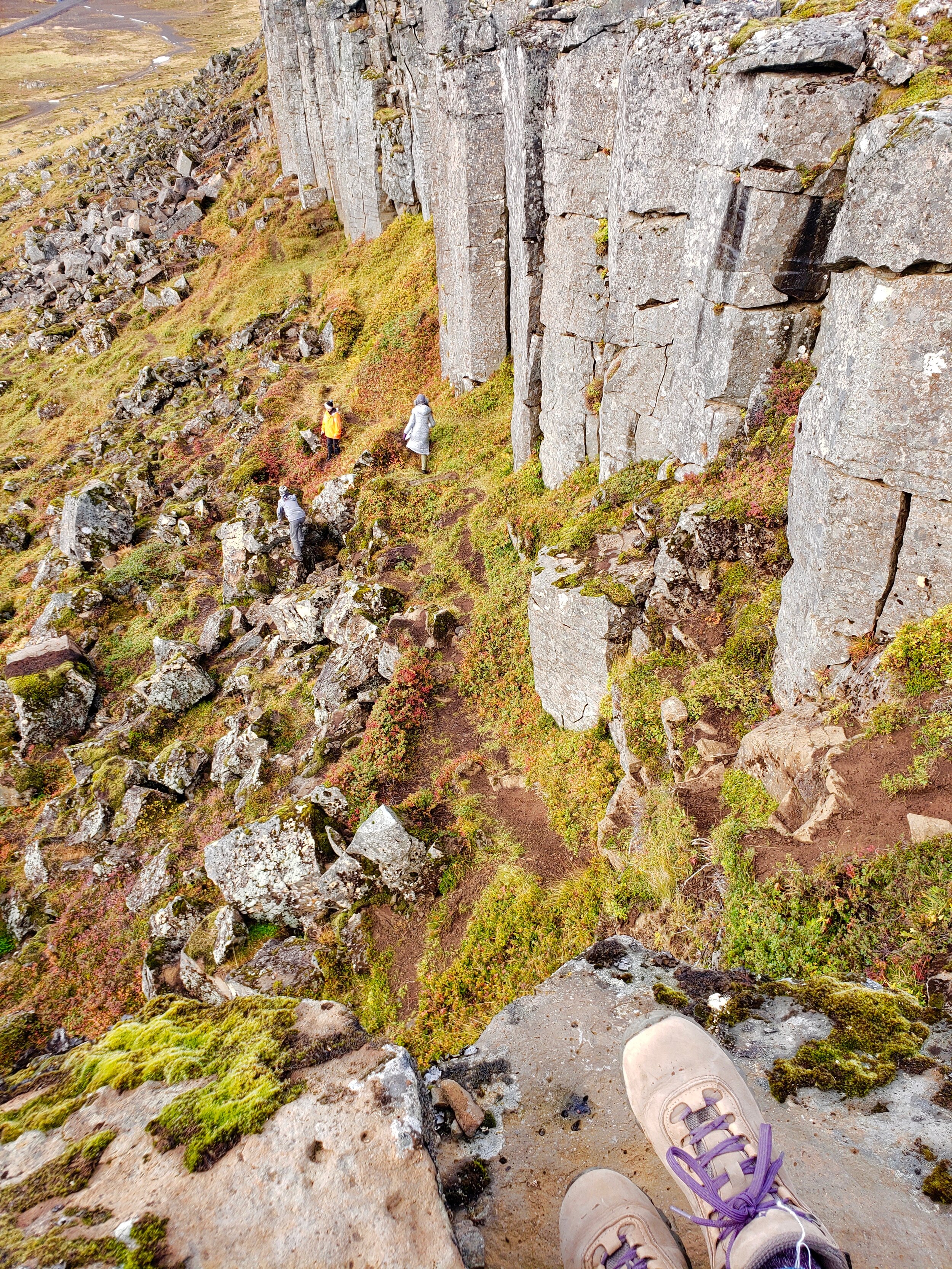
Then, it was time to head back down myself. I came back to the same ledge (which had seemed easy to descend during the ascent). However, now that I was trying to make my way down, it was suddenly more precarious. It seemed, to me, that if I were to simply hop down like my Russian friend had earlier, there was a 90% chance that I’d slip and tumble face down the side of the cliffs.
So, instead, I did an awkward body stretch so that I clung to the rock beneath me as well as to the side while stretching my legs as far down as they would go until my toes were almost touching the rocks and soil of the next ledge. Then, I sort of pushed/slid like a seal until I was safely on the path down.
Graceful.
And I wasn’t the only one who exhibited such elegance and agility. Let’s just say that I must have gotten my climbing prowess from my mother. Deciding to leave the main trail to explore some rocks of her own, she was making her way down a hillier path when suddenly, I looked over and she seemed to have disappeared.
After a minute or two, I saw her scrambling up from between rocks. She’d slipped on some moss and was massaging her shoulder as we made our way back to the car.
Luckily (as she is the only one of us who can drive a stick shift), a bit of shoulder pain is all that seemed to be bothering her.
Snaefellsnes Peninsula Stop #2: Rauðamelsölkelda mineral spring.

Fresh spring water
Delicious, minerals, fresh
The next stop on my agenda for this drive around the peninsula was a mineral spring that I’d read about. According to other blogs and articles, its clear water bubbled and produced sparkling water that tasted better than any La Croix.
According to Google maps, it was a twenty minute drive from our current location. So, we hopped in our tiny car and followed the GPS’ instructions. Back to the main road of Snaefellsnesvegur, we drove along for a while until we came across a side road where we were instructed to turn off.
On either side, glimmering bodies of water were housed between tall lava rock formations. A rainbow burst across the sky and the green tall grasses waved to us as we drove past. It was beautiful.
And it was still beautiful when the GPS told us that we had passed the spot that was supposed to be the mineral spring. Doing a U-turn on the tiny gravel road, we went back the way we’d come.
Again, the GPS told us that we’d arrived at our location. And again, there was no place to leave the road and no place to park.
Quickly (or more like slowly because there’s only so much speed you can get with 2G), I pulled up articles about the spring. After some reading, I realized that each post explained that the spring was located on the same road as the Ger∂uburg cliffs. Aka the destination we had just left.
So, we made our way back the way we’d come.
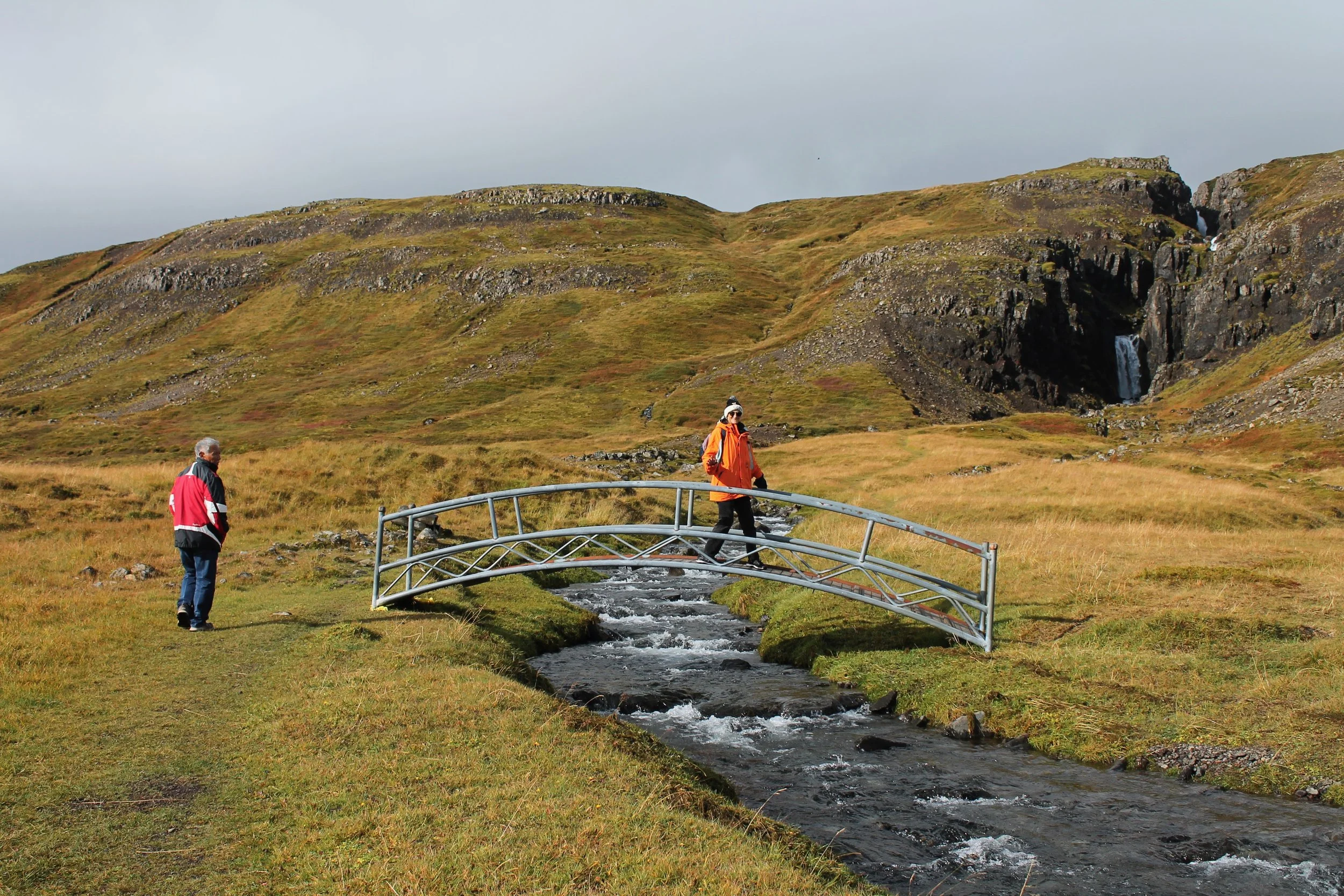
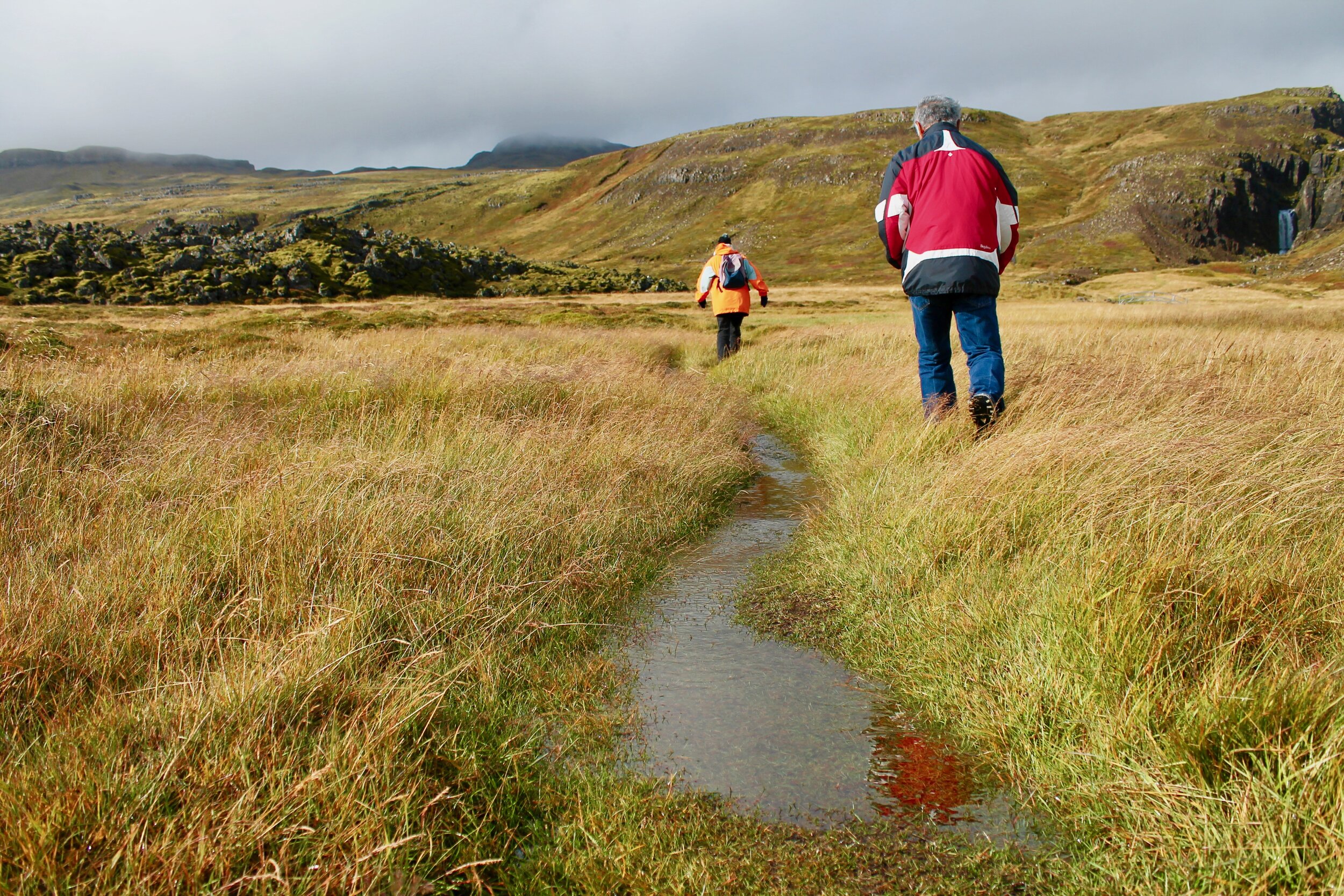
We drove up the same gravel road, past the cliffs, and up a fairly steep side road until we saw a sign that said “Rauðamelsölkelda.”
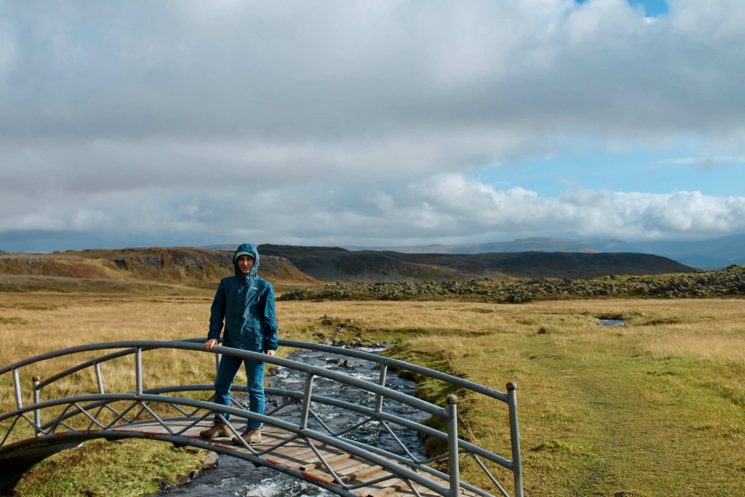
We parked the car and after a “wee” break, started walking down the path through the lava fields. The craggily rock formations rose from the earth, covered in a soft green moss. I’d read about the moss being harmed by travelers, so we were careful to stay on the path as we made our way toward a rushing waterfall. Crossing a small bridge over a stream, we walked up, searching for the mineral spring.
We were the only ones there.
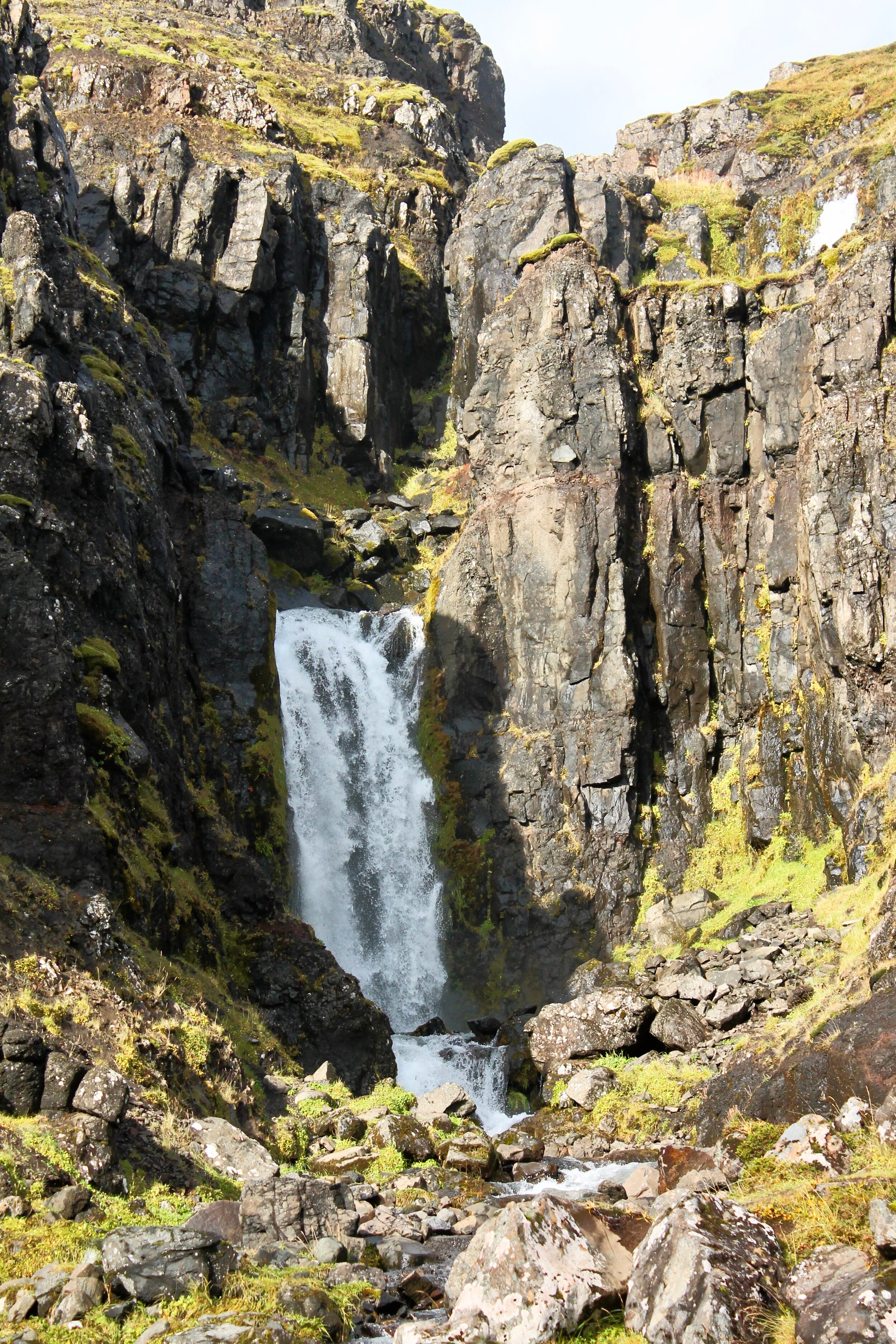
Reaching the waterfall, we were impressed by the cascading water, white from its rushing froth. However, there didn’t seem to be a spring in sight.
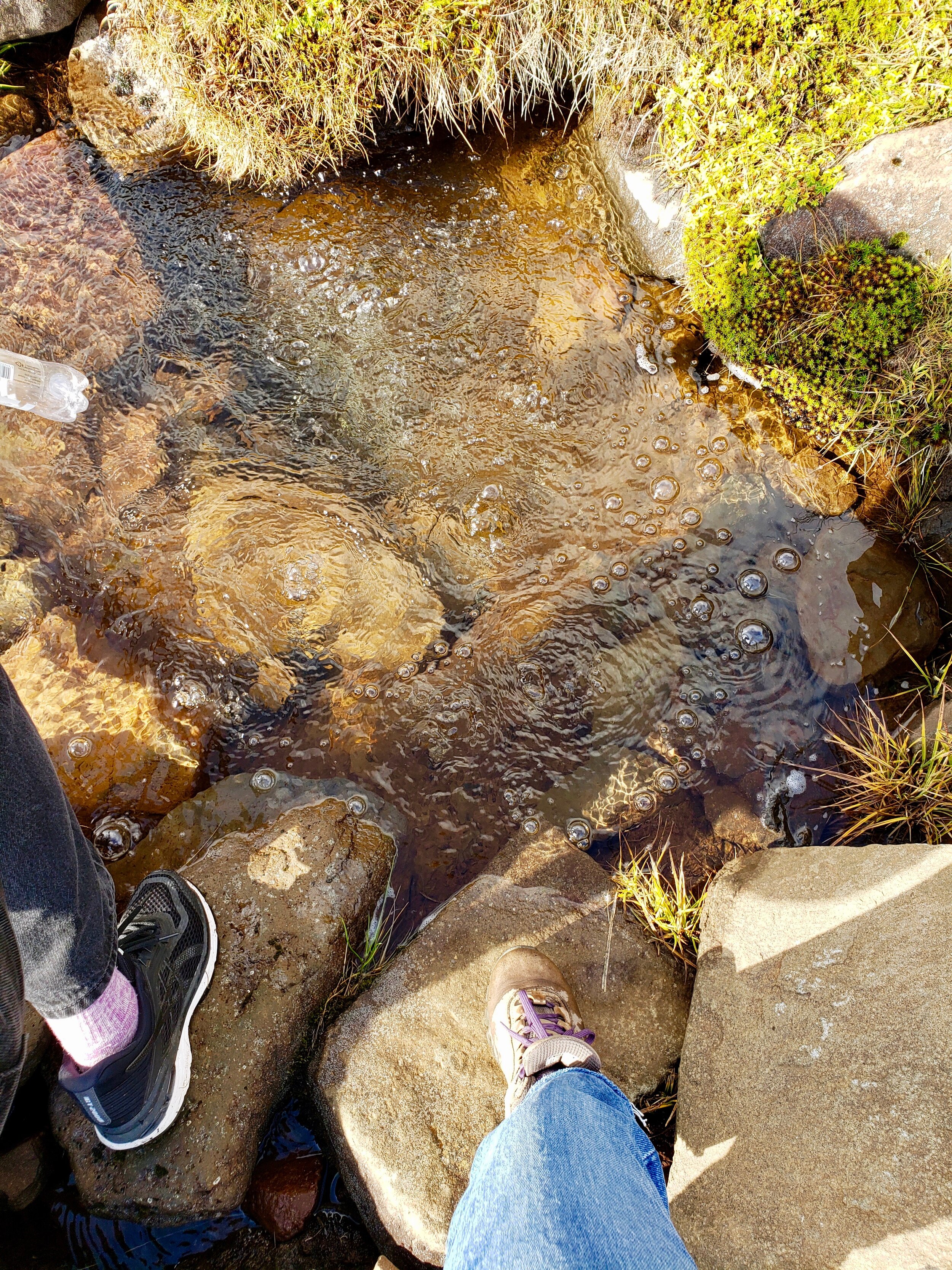
Luckily, my mom had seen a path earlier in our walk, so we decided to embark out to the left, away from the falls. I’d seen a picture of the spring and after a short five minute walk, saw something that looked similar in the distance.
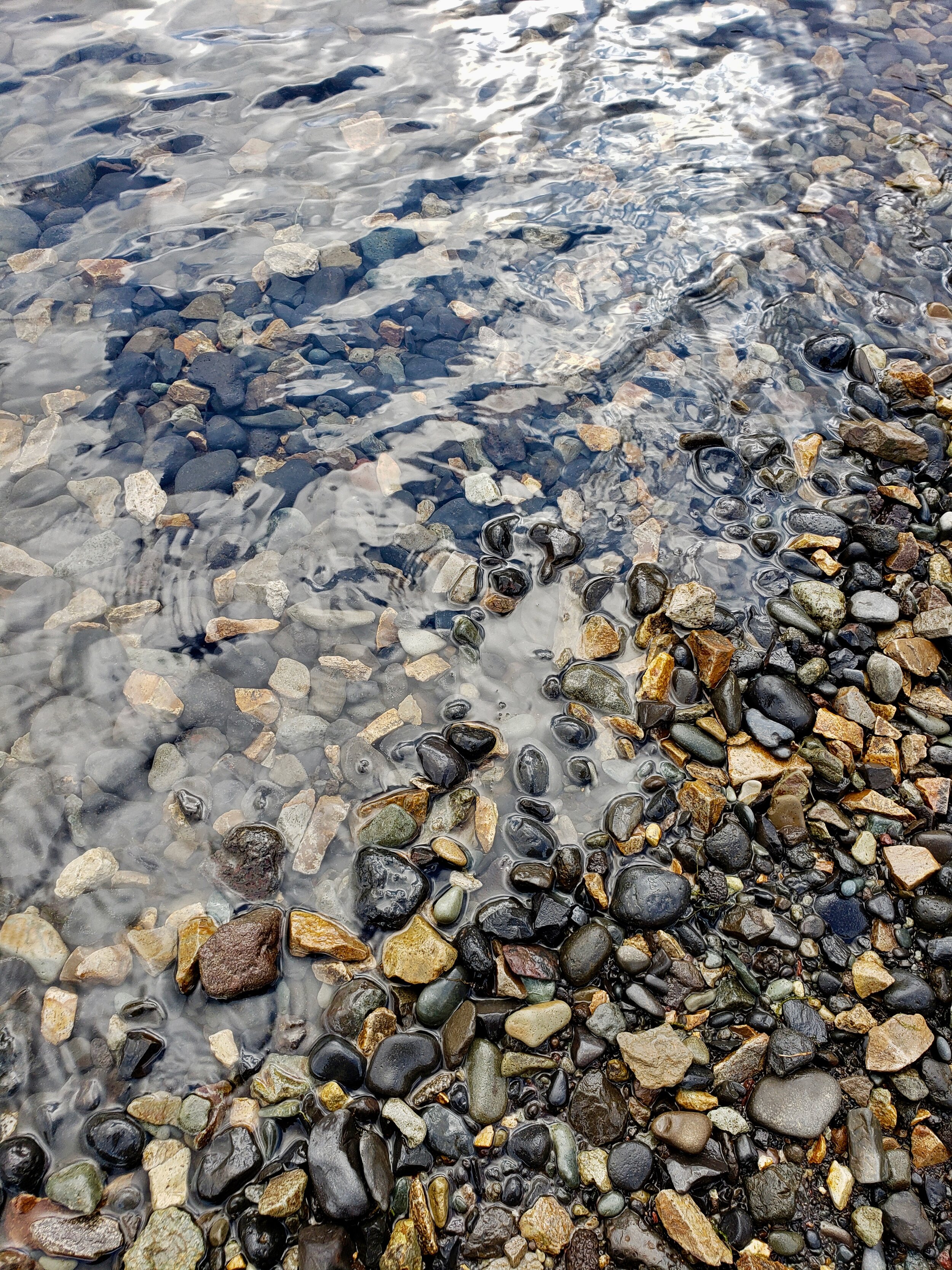
Sure enough, we arrived at a bubbling mineral spring. Filling our water bottles, we were amazed (even though we’d read this more than once), that it tasted like sparkling water. Perrier de Island, if you will. It was thirst quenching and lovely and worth every moment driving around those roads.
Then, we trekked back through the lava field and got back into the car. After a bit of a discussion, we decided that it was worth it to make the 1 hour drive to the Snaefellsnes National Park.
Sleepiness set in as we drove along the winding roads. The scenery around us was incredible. Almost alien with its unique terrain of lava, grasses, red, brown, and green mountain faces, and strange fuzzy moss. Still, the movement of the car and the endless expanses of scenery lulled us until we almost didn’t feel safe driving anymore.
We did wake up a bit as we passed a huge waterfall that was sharp and horizontal at its top. We slowed to admire its powerful magnitude and wonder about who lived in the two houses near its base.
Snaefellsnes Peninsula stop #3: Londrangar basalt cliffs
And, finally, we had our first stopping point. The Londrangar basalt cliffs. Poised in the midst of crashing waves, rocks stood like towers in the North Atlantic sea. Again, it felt like we were looking at something alien; from another planet. Their strange shapes, dark and porous stood like creatures in the water. Meanwhile the faces of the cliffs that we stood on were sheer. Actually, the cliffs themselves reminded us a lot of the cliffs of Moher that we’d seen in Ireland. Just a miniature version.
We took some time to walk around before heading back into the car to drive through the rest of the park.


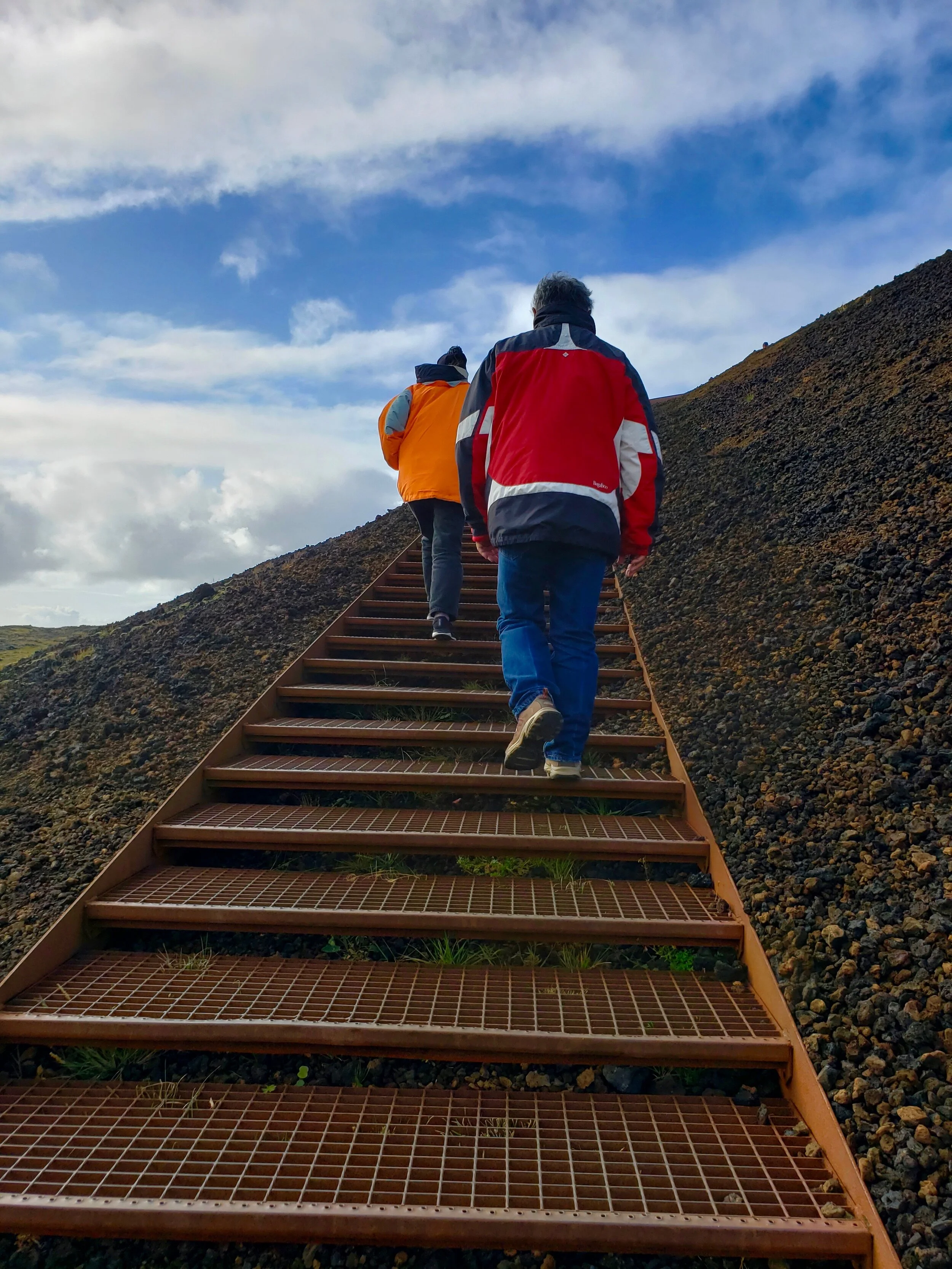
Snaefellsnes Peninsula stop #4: Saxholl crater
As we drove, we saw what looked like people climbing up a red, winding line. We decided to take another stop and pulled into a parking lot at the base of a hill. Up close, we saw that the red line was actually a winding set of stairs that led to the top of this hill (which turned out to be Saxholl crater). Parking, we faced the wind and the vertical steps, walking slowly up to the top.
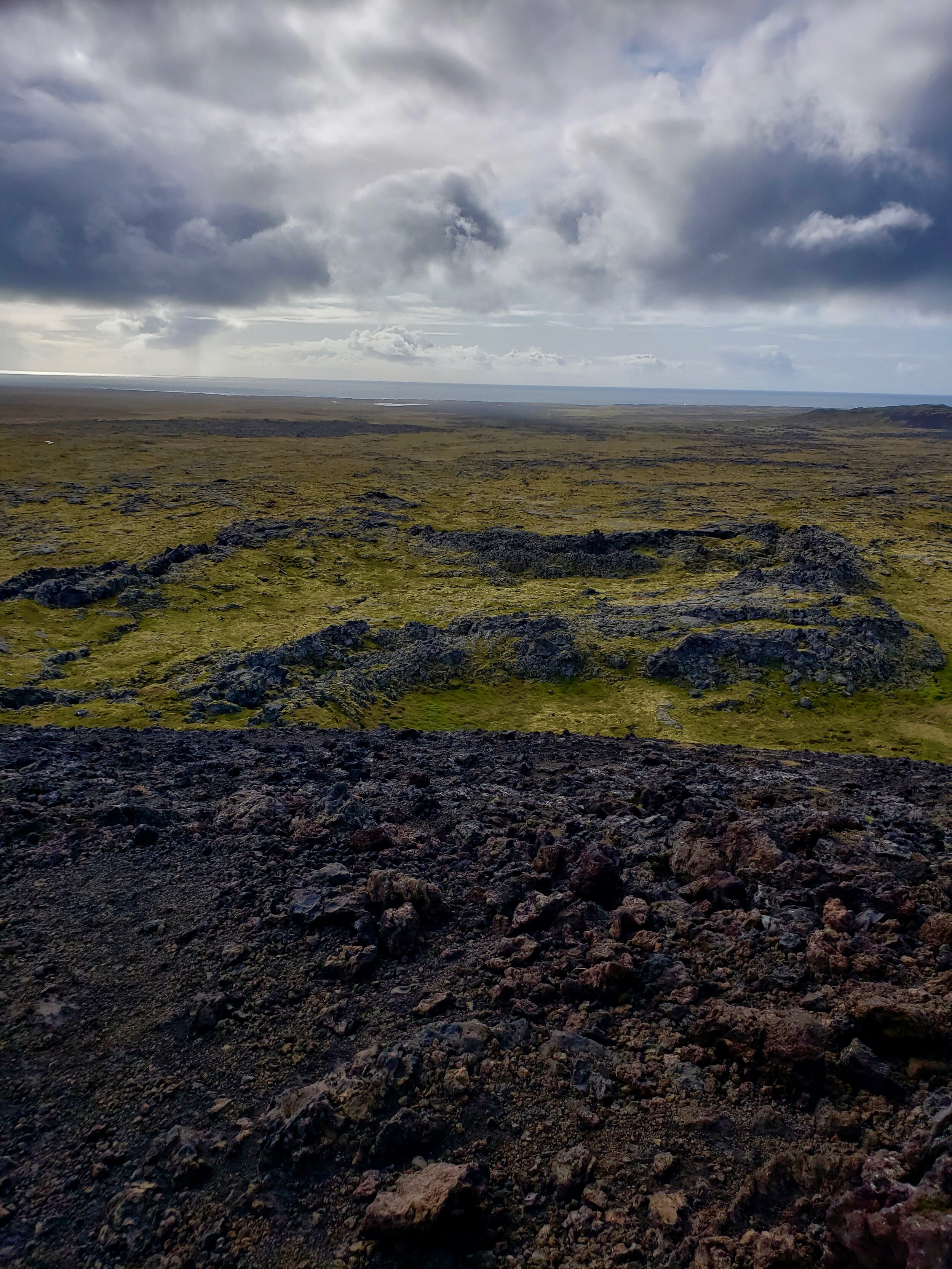
There, we stood and looked out at the moss covered lava fields and what looked like an abandoned gnome fortress. Since there are most definitely elves and other hidden people still living in Iceland, we figured that that’s what the rectangular set of lava rocks must have been.
It felt so great to stretch our legs and filled us with enough energy to make our way back into the car for the next portion of our drive.


Snaefellsnes Peninsula stop #5: The town of Hellissandur
We decided to make a small pit stop in the fishing village, Hellissandur, where a maritime museum was located.
Outside the museum were two cabins, painted black, with green moss covering their roofs. These turned out to be replicas of fisherman’s houses from a time long ago.
Inside, the girl who greeted us seemed uninterested in our presence and, without so much as a smile, gave us our tickets. Exploring the museum, we learned about fishing in Iceland, what it meant to make a living off of the sea, and how it’s evolved over the years. We also learned that Hellissandur has a population of about 400 people… Can you imagine? I think that’s how many people work on my floor in my office.
Before we knew it, it was already time to head off again—because we had to reach a special café that I wanted to share with my parents before it closed at 5pm.
Leaving the museum, the girl who’d given us our tickets smiled and nodded. I realized that this was just how people are in Iceland. They’re straightforward, no-nonsense, yet ultimately, very nice.


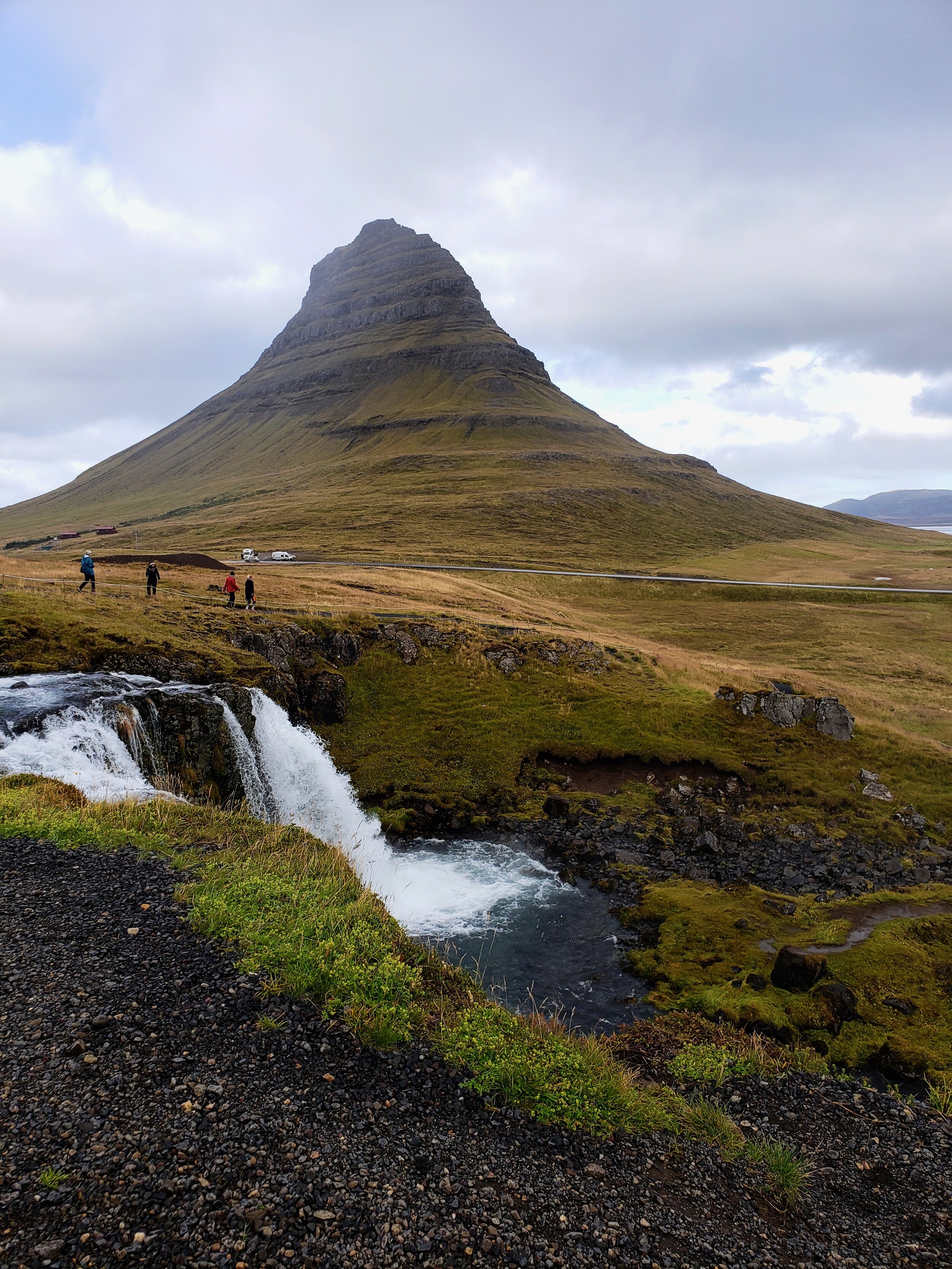
Snaefellsnes Peninsula stop #6: Kaffi Emil in Grundarfjör∂ur.
Back in the car, I was excited to reach Kaffi Emil. I’d been there two years ago and had been amazed by the fish soup and chocolate cake served in this tiny establishment.
My mouth watered thinking about both as we drove up the long roads and past Kirkjufell and Kirkjufellfoss (where we’d be returning after we’d had our meal).
Pulling into the small parking lot of Kaffi Emil, we got out and went inside the cafe/museum/bookstore/travel office. Yes, inside this tiny structure could be found just about everything you need: viking history, literature, travel information, and the best fish soup you’ll ever eat.
Walking up to the café’s counter, a cheery woman with a big smile greeted us happily. We ordered one bowl of mushroom soup, one fish soup, one panini, and two slices of chocolate cake.
Side note: I am wondering if I should start buying larger pants now or when I get back to San Francisco.
With the soups, we each got a complimentary coffee and tea then walked to a little table to sit and enjoy the meal. It did not disappoint. The creamy mushroom soup was savory and hot, perfect for dunking the small rolls of bread into. When the fish soup came out, its melt-in-your-mouth bites were both sweet and savory as the white chunks of fish soaked up the bisque-like flavor of the soup.
The two giant slices of chocolate cake were also devoured with happiness.
During our little lunch/dinner in this café, a family came in. We heard them call one of their children “Kai.” Later, the woman yelled at her son to come over to her with “Eh! Kai!”
So, of course, we assumed that they too were from Hawaii.
Finishing up our meal, we decided to walk outside for a bit. Stepping out into the cold, we realized that there was a grocery store across the street. Before we would walk, we would send my dad inside to grab a few beers for the night.
The grocery stores in Iceland do, indeed, sell beer. However, these are 2% beers (which is actually perfect for me and mom who are “one-beer wonders”).
At this exact moment, the family came out and we had to ask…
“Are you from Hawaii?” my mom inquired of the woman.
She looked at us oddly and replied, “no.”
“Oh,” my mom said, “we heard you calling your son and that his name was Kai.”
(It wasn’t as creepy as it sounds here in this blog post).
“That’s a Hawaiian name,” my mom explained, “is yours spelled ‘Ky’ instead of ‘Kai’”?
“Ah,” the woman responded, “actually it is spelled ‘Kai.’ It means warrior.”
“Wow! It means ocean in Hawaiian. Our son is actually named that too.”
“That’s beautiful,” the woman said smiling as her son Kai came over.
They then explained that they were only there for a couple of days and had come from Washington D.C.
After chatting a bit more we parted ways and my dad went on his mission in the grocery store. Then we walked down to the shoreline to see the deep blue water and Kirkjufell mountain from another perspective.
Then it was time to actually drive up to the mountain and the adjacent waterfall.
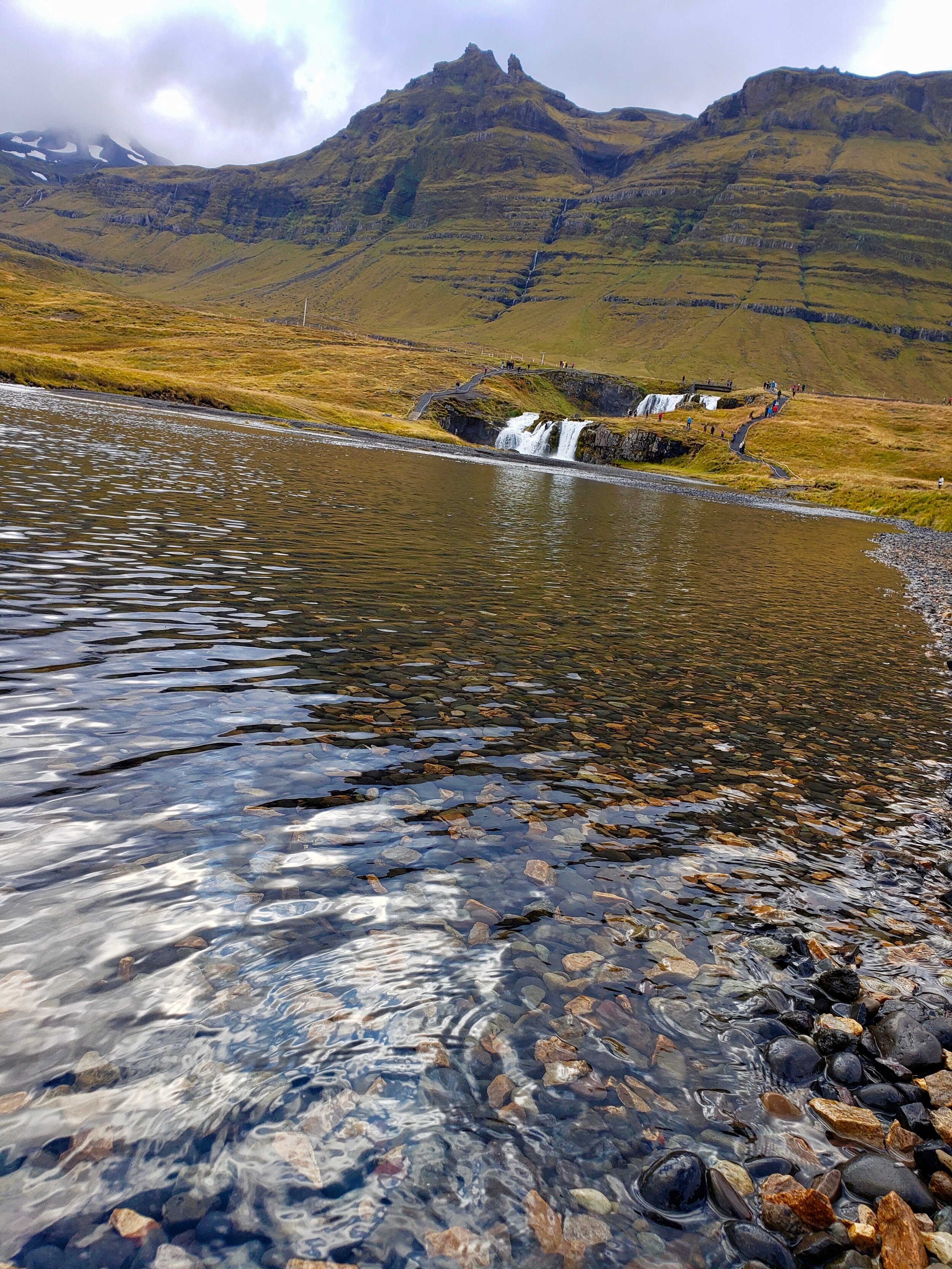
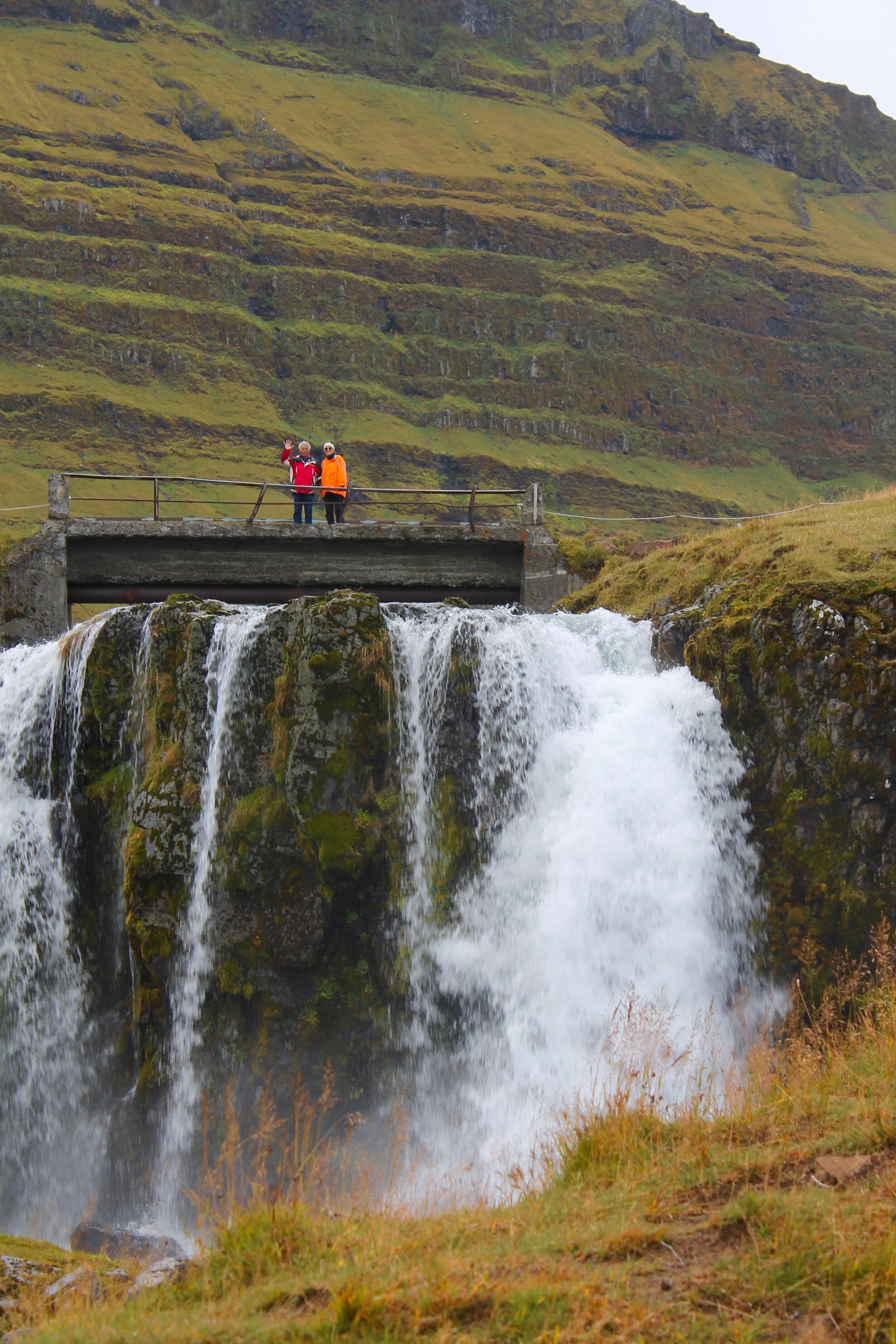
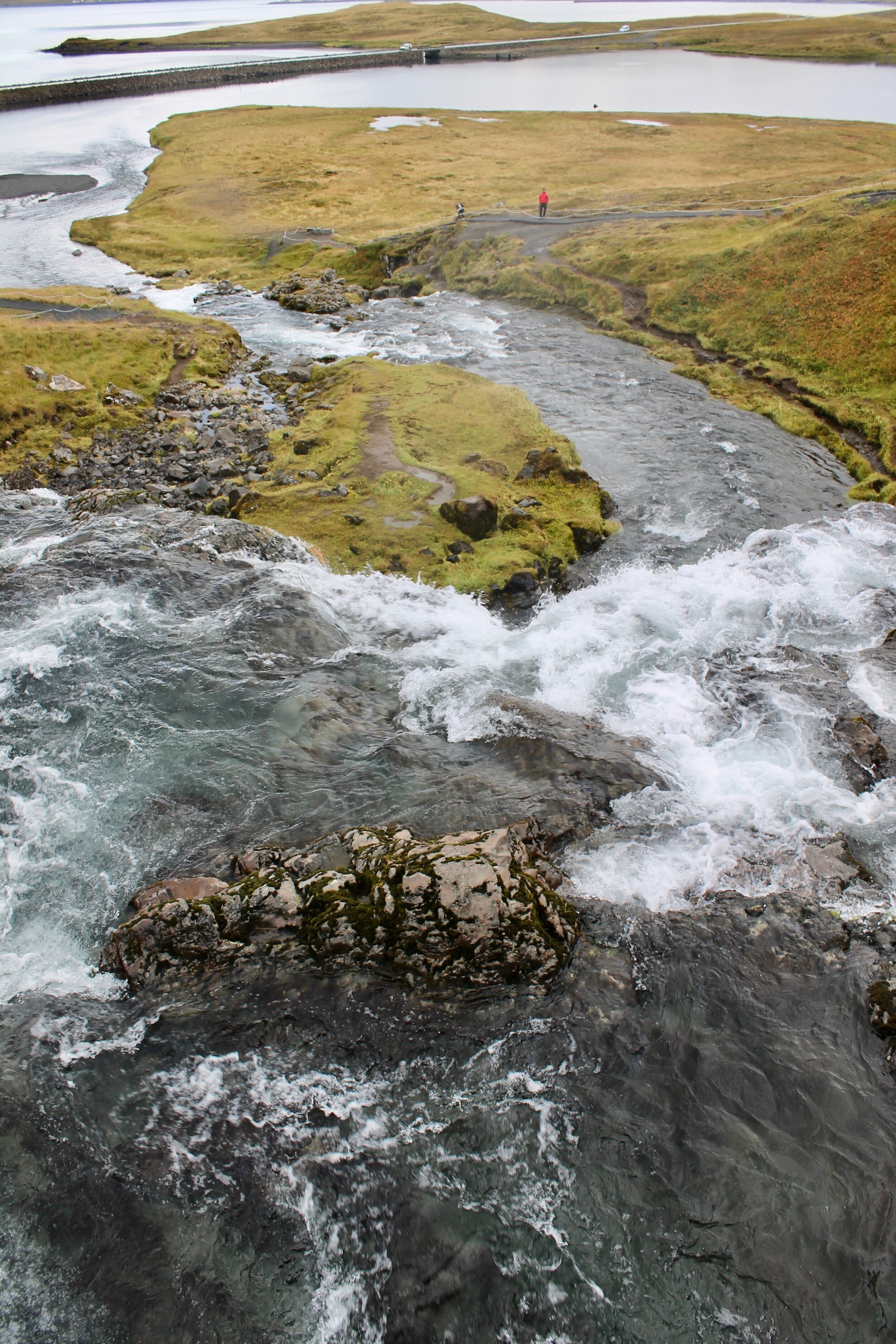
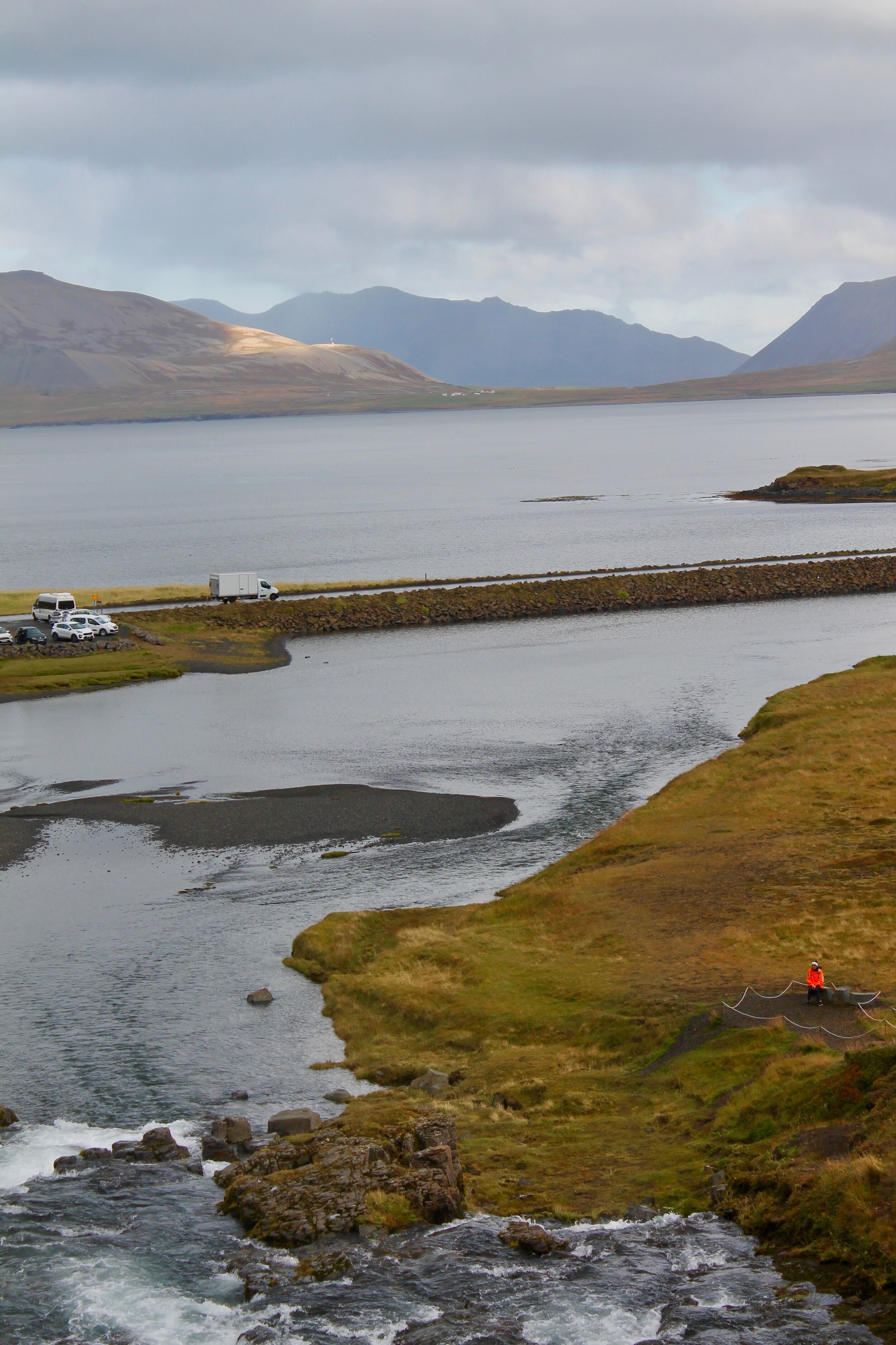
Snaefellsnes Peninsula stop #7: Kirkjufell & Kirkjufellfoss
It was shocking how busy both the mountain and the waterfall were at 5pm at night. The sun sets at around 9:00pm during September in Iceland, so it makes sense, but was still a bit of a shock. And, it was quite a challenge to find parking in order to get out of the car to view these natural wonders. In fact, a police officer was giving tickets to people who were parking on the side of the road instead of in the parking lots.
We drove back and forth a couple of times until we saw that people were parking in a small area up the road. The police officer was there and made it clear that it was okay to park there.
As we were getting out of the car, some people around my age were complaining about having been scolded for trying to park on the side of the road.
Of course, if they’d done any research at all (and I mean read just one article about driving in Iceland), they would have known that it is illegal to stop outside of a designated viewpoint or parking lot. It’s literally written in just about every blog/article/guide that you can find. But, as my former Iceland tour guide would say, “people are people.” And there’s no changing them.
We then went to view waterfall up close. My irritation at the other visitors left as we drew closer. It’s crashing waters and the crystalline surface at the base are so astounding. You can’t fault people for wanting to come and see it. To be close to something like that. Even if they don’t do their research beforehand.
Turning around, we could see the towering mountain Kirkjufell (and some crazy rock climbers) reaching toward the gray sky. It reminded us so much of a familiar mountain off of Oahu (Chinaman’s hat or mokolii). The familiarity in this strange and far off land felt comforting and mysterious.
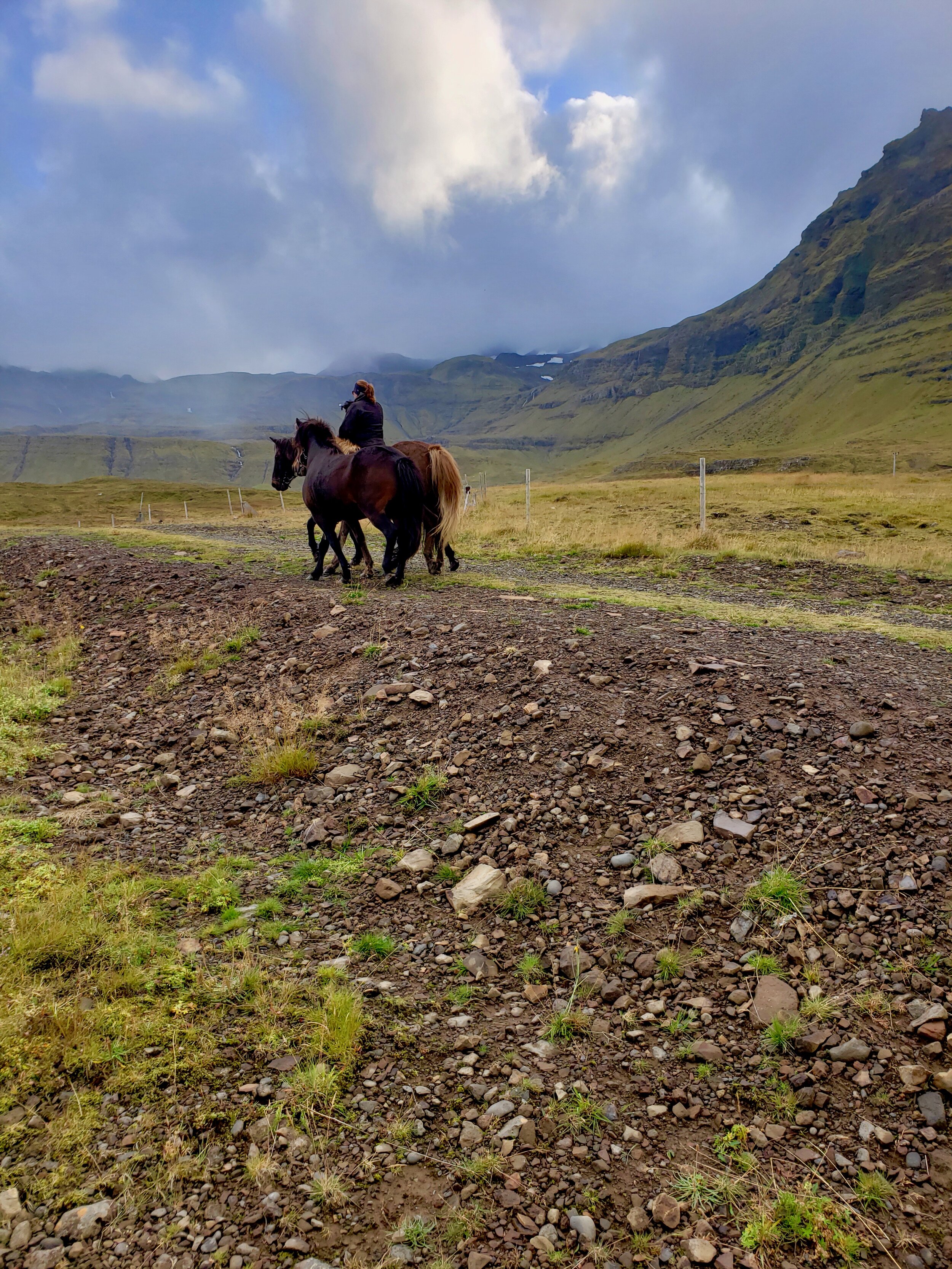
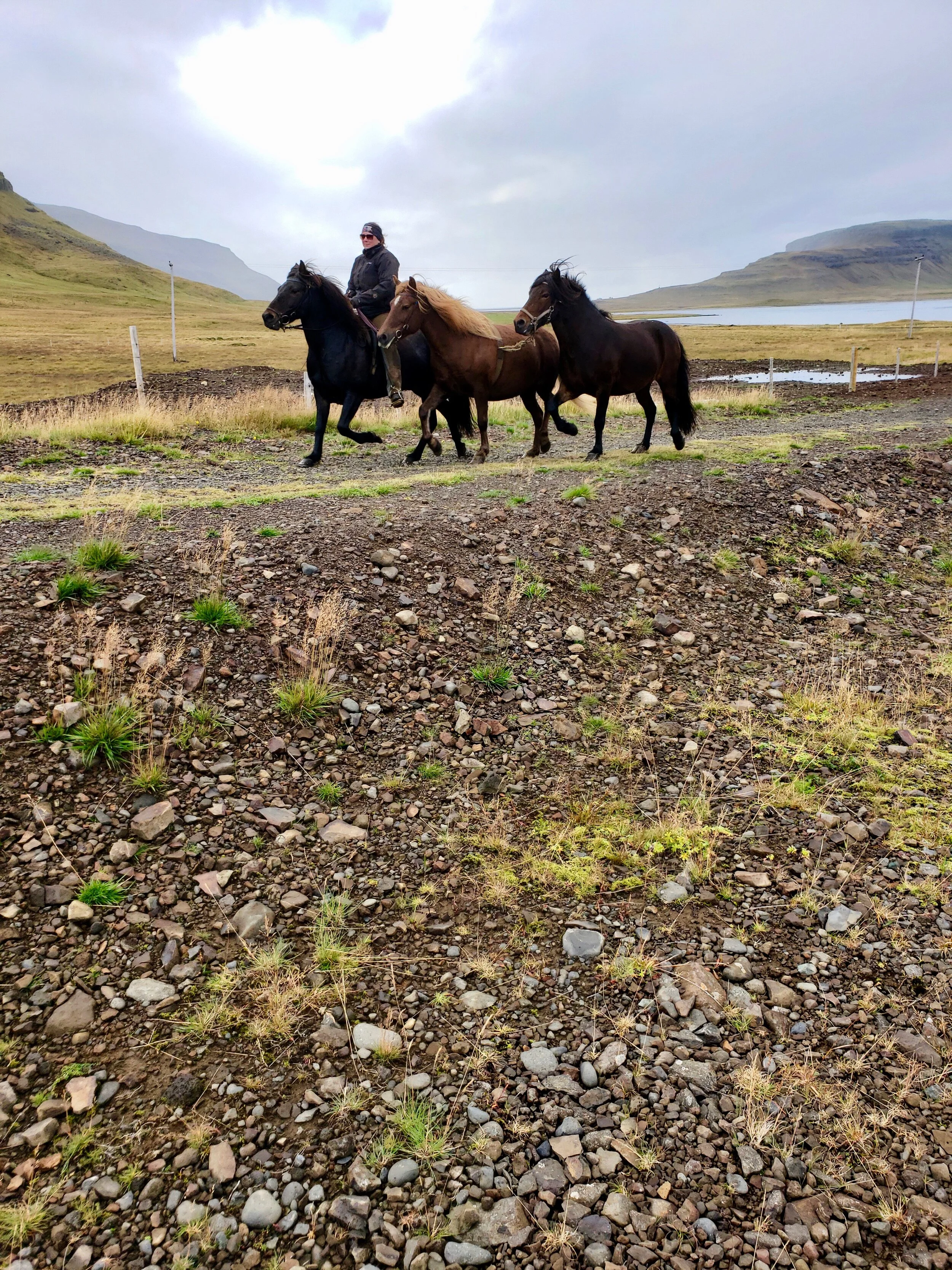
One our way back to the car, however, I think was the highlight: HORSES. ICELANDIC HORSES. MY FAVORITE ANIMALS IN THE WORLD trotted by.
A woman was training two young horses to run alongside her and her own horse. They trotted about the trails, getting used to staying together, the rocky terrain, and being near people.
[The mistake/not so much…]
On our way back to our little cottage by the shore, I realized that I’d missed one spot on our agenda: Bjarnarfoss. I’d wanted to see this famous waterfall during our drive back from the Snaefellsnes National Park.
Annoyed with myself for having missed this during our drive, I began doing some desperate research to see if we could squeeze a view of this cascade during the next day’s drive to Reykjavík. Unfortunately, it was quite out of the way. With a sigh, I was about to click out of the browser on my phone, when, instead, I clicked on an image of the waterfall.
To my surprise and joy, it was the exact rush of water that we’d passed on our way to the National Park earlier that day.
We’d even stopped for a moment to admire the way it crashed sharply from the top of the mountain. It was that same waterfall that fell so near to those two little houses—the ones we’d wondered about and had tried imagine who lived there.
Happily, I could mentally check it off my list of beautiful scenes to view on the west coast.
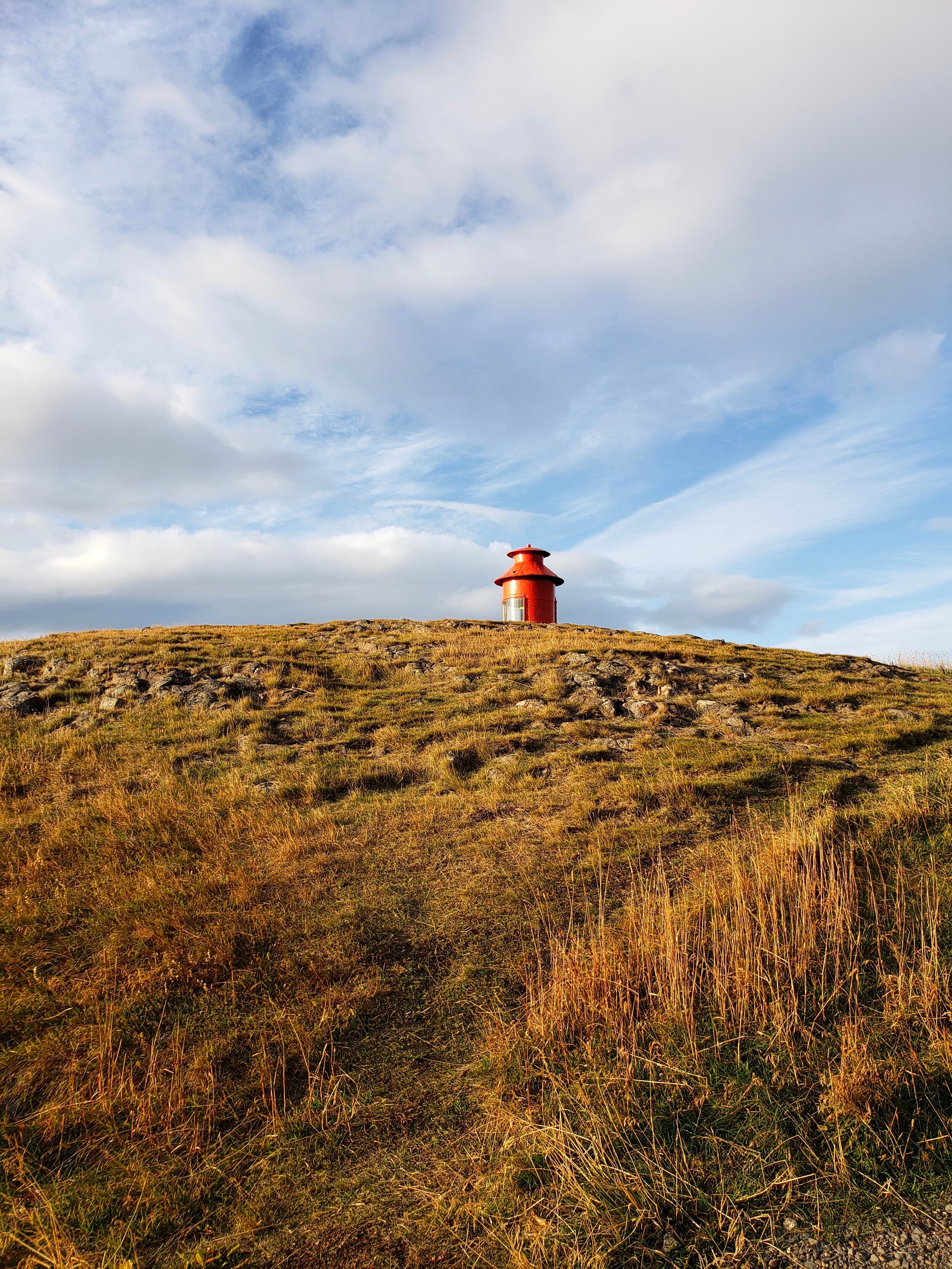
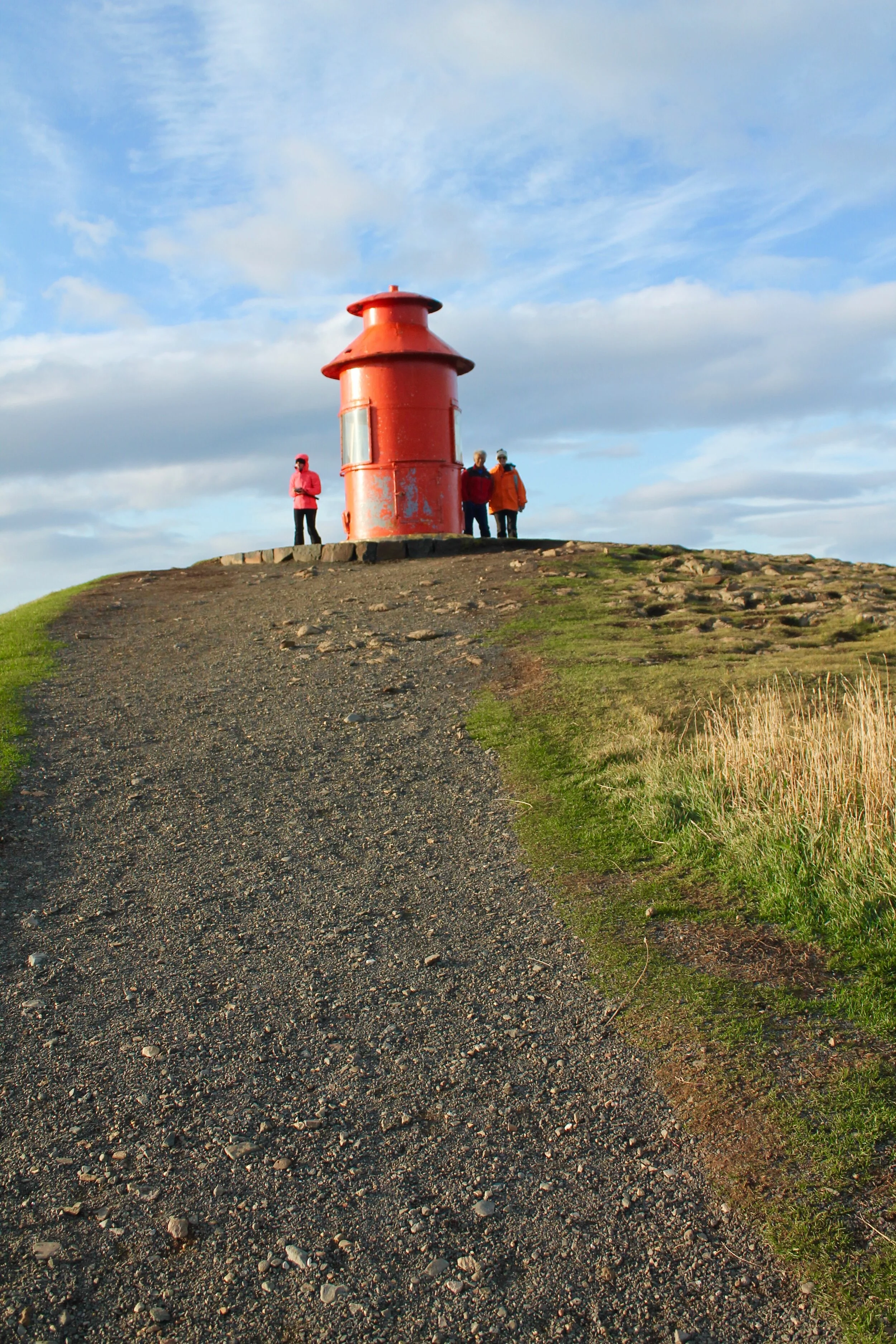
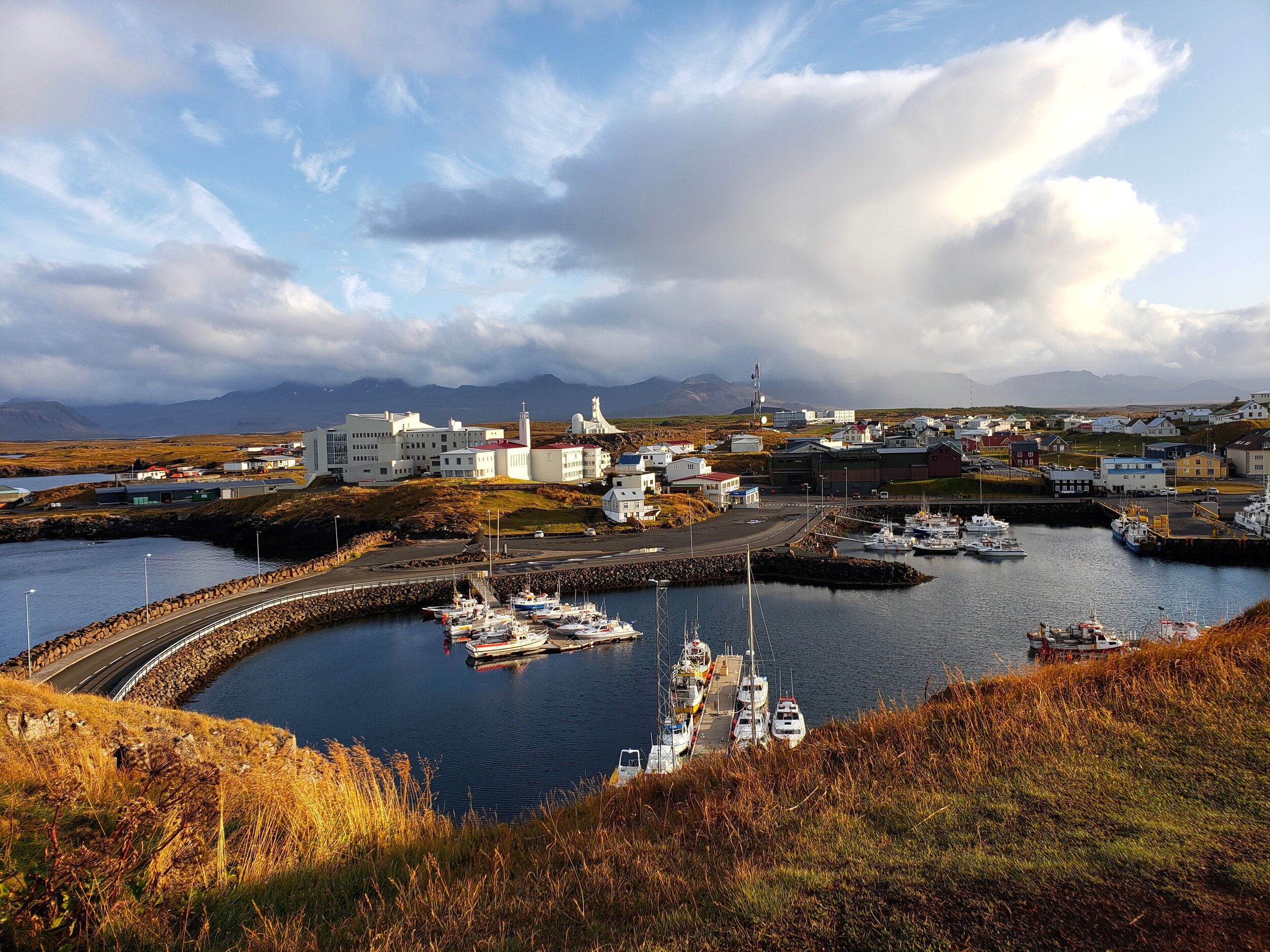
Snaefellsnes Peninsula stop #8: The Stykkishólmur lighthouse
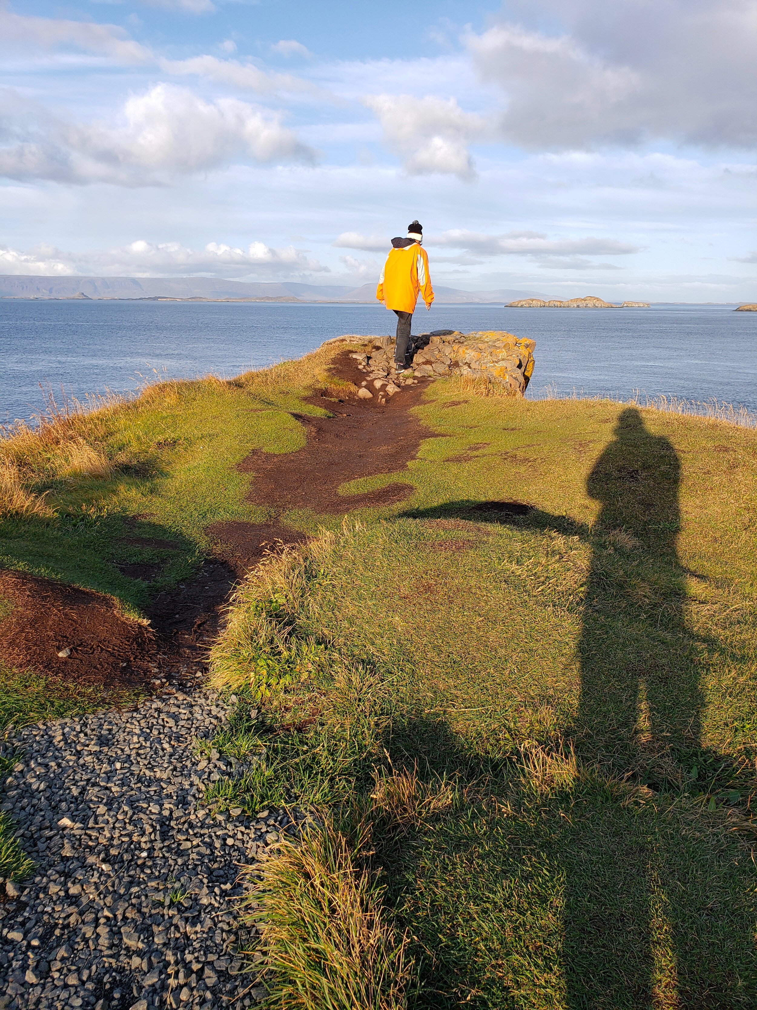
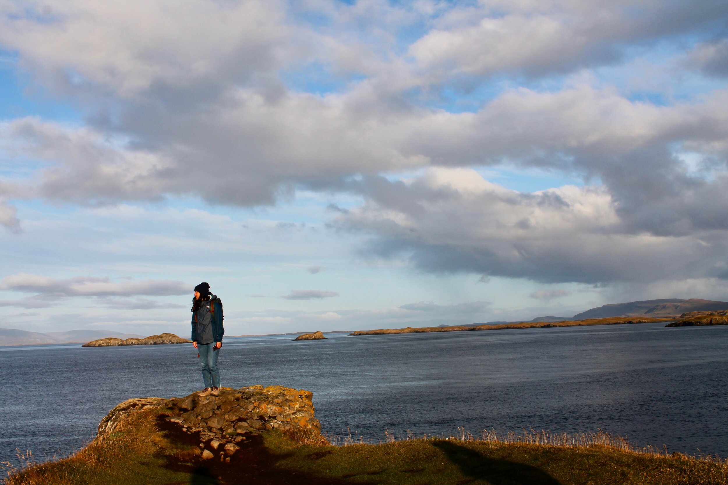
Back in our little town of Stykkishólmur, we decided to explore the nearby cliffs and the little orange lighthouse on top. Walking up the steps, we took in views of the surrounding North Atlantic waters and our own little neighborhood.
From where we stood, we could see the colorful houses on the hills and the ships bobbing in the harbor. It looked like something out of a storybook; like a little toy village that you’d have as a kid with a choo-choo train that you pulled between the cottages.
It was almost too perfect and idyllic to look at.

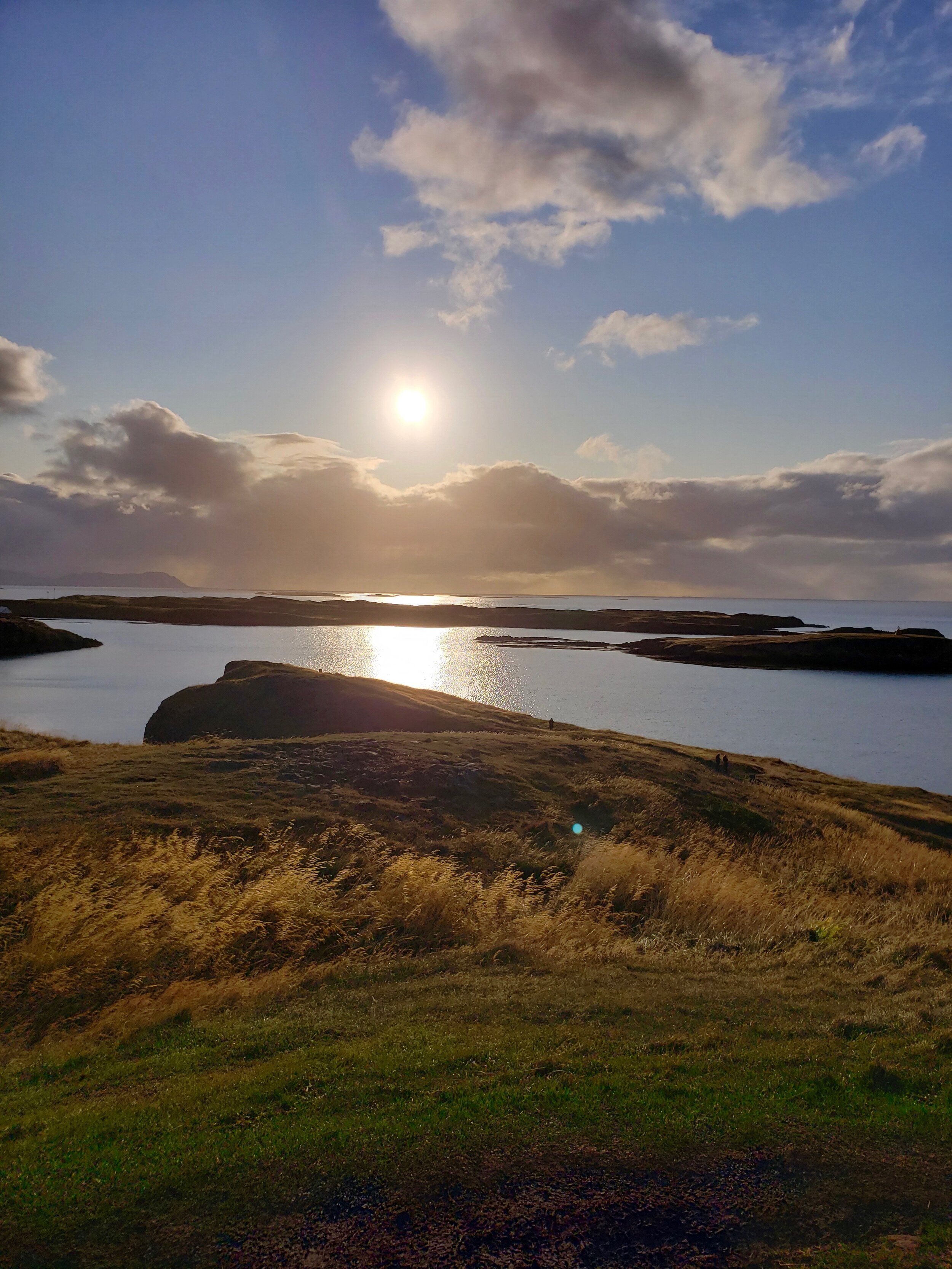
As the sun began to lower toward the dark water, we decided to head back to our little pink airbnb in order to enjoy another evening in the hot waters of their outdoor tub.
Back at the cottage, we looked out over the North Atlantic sea as seagulls called out and raced across the sky. 2% beers in hand, we stayed and watched the setting sun. Finally, we were exhausted. Heading back inside, I explored the house’s movie collection and discovered that the homeowners actually had both The Life Aquatic as well as the full first season of Thundercats. In other words, it was meant to be that we ended up in this little house.
We’d spent the day exploring the west coast of Iceland, taking in the waterfalls, the history, the food, and the alien-like environment. It had been exhausting and magical and so genuine. We’d experienced nature. Drank from springs and rivers, climbed rocks, stood at the base of waterfalls, watched horses running past.
It was food for the soul. Delight for the eyes. Magic for the heart.